Snow, Cold Temperatures On Tap For This Weekend
.jpg)
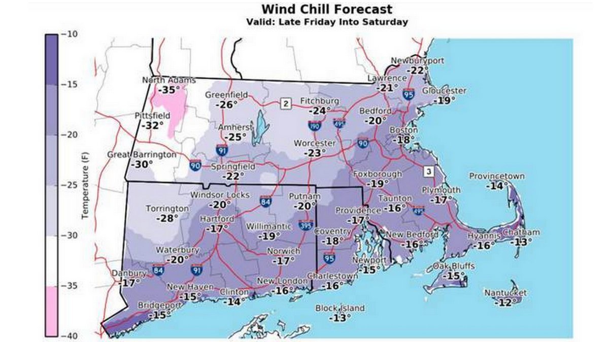
The National Weather Service says temperatures will continue to be bitter cold and another 3 to 5inches of snow is expected to fall this week. A coastal storm is expected to coat the entire state with snow and the wind-chill factor will make it as cold as minus-35 degrees in the Berkshires.
"The National Weather Service is forecasting a strong coastal storm on Thursday that will bring accumulating snow across the entire state, with the eastern half of the state seeing the greatest amounts. Strong and possibly damaging winds are also expected, with the greatest threat along the coast, including the Cape and Islands. Starting on Friday, bitterly cold weather will return and persist into the weekend," reads an alert put out by Christopher Besse, Massachusetts Emergency Management Agency's public information coordinator.
The forecast calls for snow to start early Thursday morning and last throughout the day. The snowfall rate could be as much as one to two inches per hour.
The storm moving north along the East Coast from Florida is being described as a "bomb cyclone" because its pressure could drop so fast. The center of the storm is expected to be off the coast, south east of Cape Cod, and could create blizzard conditions in some coastal areas.
The greatest amount of snow is expected in eastern and central Massachusetts, where between 8 and 12 inches are expected. Berkshire County is expected to see less, with about 3 to 5 inches falling.
Wind gusts in Pittsfield will be as much as 33 mph while on the eastern part of the state, the gusts could get up to 65 mph.
On Friday, frigid temperatures will come into the Berkshires. The daytime temperature on Friday and Saturday is expected to stay somewhere around 0 and then drop to between minus-10 and minus-20 overnight.
MEMA says the wind chill on the weekend is potentially life-threatening and can cause frostbite and hypothermia in as quickly as 30 minutes. MEMA also expected an increase in fires and carbon monoxide poisoning from unsafe use of alternative heating sources, and possible water main breaks, pipe bursts, and vehicle failure.
MEMA previously released the following safety tips.
• Dress in several layers of loose-fitting, lightweight clothing instead of a single heavy layer. Outer garments should be tightly woven and water repellent. Wear a hat, mittens (not gloves), and sturdy waterproof boots to protect your extremities. Cover your mouth with a scarf to protect your lungs.
• Watch for signs of frostbite and hypothermia. Frostbite causes a loss of feeling and a pale appearance in extremities, such as fingers, toes, ear lobes or the tip of the nose. If symptoms are detected, seek medical help immediately.
• The warning signs of hypothermia include uncontrollable shivering, memory loss, disorientation, incoherence, slurred speech, drowsiness and apparent exhaustion. Get the victim to a warm location. If the person's temperature drops below 95 degrees, seek immediate medical care.
• Have a well-stocked home emergency kit that includes a flashlight, sleeping bag or blanket, portable radio, extra batteries, a first aid kit, bottled water and non-perishable food. Add seasonal supplies to your emergency kit such as extra winter clothing and blankets.
• Make sure your car is properly winterized. Keep the gas tank at least half-full. Carry a winter emergency car kit including blankets, extra clothing, a flashlight with spare batteries, a can, waterproof matches (to melt snow for drinking water), non-perishable foods, windshields scraper, shovel, sand, towrope, and jumper cables in the trunk.
• Be a good neighbor. Check on family, friends, and neighbors, especially the elderly, those who live alone, those with medical conditions, and those who may need additional assistance.
• Limit outdoor time for your pets. Freezing temperatures are dangerous to animals as well as humans.
• Wrap pipes in insulation or layers of newspapers covered with plastic to keep them from freezing. Allow a trickle of warm water to run from a faucet that is farthest from your water meter or one that has frozen in the past. This will keep the water moving so that it cannot freeze. If pipes freeze, remove insulation, completely open all faucets and pour hot water over the pipes or wrap them with towels soaked in hot water, starting where they are most exposed to the cold. A hair dryer, used with caution, works well to thaw pipes.
• Although temperatures may be cold, bodies of water covered in ice are likely unsafe given recent temperature fluctuations. Residents are urged to stay off frozen bodies of water until ice is at least 4 inches thick.
• Ensure you have sufficient heating fuel, as well as alternate emergency heating equipment in case you lose electricity. When utilizing alternate heating sources, such as an emergency generator, your fireplace, wood stove, or space heater, take necessary safety precautions:
• Keep a fire extinguisher handy and ensure everyone knows how to use it properly.
• Never heat your home with a gas stove or oven or charcoal barbecue grill.
• Make sure all heating devices are properly ventilated and always operate a generator outdoors and away from your home. Improper heating devices can lead to dangerous carbon monoxide (CO) buildup in the home. Make sure you test smoke alarms and carbon monoxide detectors. Carbon monoxide is an odorless, colorless gas that can cause flulike illness or death. If you suspect carbon monoxide poisoning, call 911 immediately, get the victim to fresh air, and open windows.
• Keep anything that can burn at least three feet away from space heaters. See more winter heating safety tips from the Department of Fire Services.
If you need information on the location of open warming centers or shelters check with local authorities or call 2-1-1
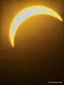
All day Thursday meteorologists are going to be glued to the new GOES-East satellite watching a truly amazing extratopical "bomb" cyclone off New England coast. It will be massive -- fill up entire Western Atlantic off U.S. East Coast. Pressure as low as Sandy & hurricane winds pic.twitter.com/6M4S3y75wT
— Ryan Maue | weather.us (@RyanMaue) January 2, 2018
Tags: frigid, snowstorm,