

Up to 6 Inches of Snow Predicted for Berkshires
.jpg)
TONIGHT: Partly Cloudy (Increasing High cloudiness)....Cold
— Steve Caporizzo (@SteveCaporizzo) January 25, 2021
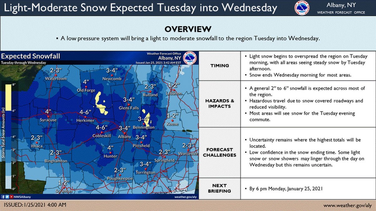
TUESDAY: Snow arrives 11am to 1pm.
Steadier mid to late afternoon and at night.
Widespread Accums 4-6".....6-9" Southern Adirondacks-S. VT Mountains/Northern Berkshires. pic.twitter.com/8w1eD6VcUn
With snow expected to begin Tuesday afternoon, good time to look at probabilities. By Wednesday morning, there is a 30-40% chance of 4" of snow or more in the Greater Capital District. So a 2-4" forecast at this point looks good. Best chance of <4" in the Southern ADKs. @WNYT pic.twitter.com/bDeazOK3AF
— Paul Caiano (@PaulCaiano) January 25, 2021
Updated snowfall and ice accumulation forecasts. The latest forecast track for the second storm (Wed-Wed night) is trending faster and farther south, with intensification taking place farther offshore. pic.twitter.com/JnouK5g2qG
— NWS Eastern Region (@NWSEastern) January 25, 2021
Updated snowfall and ice accumulation forecasts. The latest forecast track for the second storm (Wed-Wed night) is trending faster and farther south, with intensification taking place farther offshore. pic.twitter.com/JnouK5g2qG
— NWS Eastern Region (@NWSEastern) January 25, 2021
Tags: snowstorm,