Snow on the Way; Preview for Southern Vermont on Wednesday
Very slight chance for delays Thursday for Northern Berkshire towns, especially those in higher elevations. Bigger storm this weekend will start Saturday. https://t.co/i1mn9OQbNE
— Greylock Snow Day (@GreylockSnowDa1) January 16, 2020
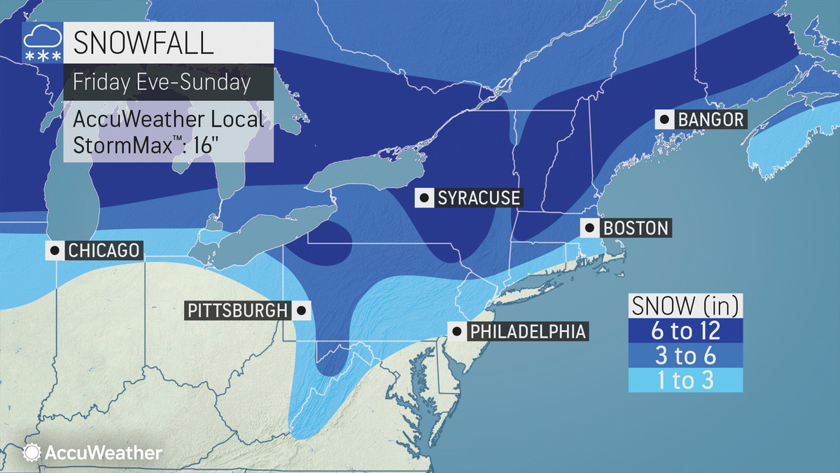
Updated snowfall forecast tonight through Thursday. There were some minor changes mainly to increase snow amounts slightly. We are now expecting around half inch to an inch for the Capital District overnight which could result in some slippery travel for the early morning commute pic.twitter.com/SaC7aj8szK
— NWS Albany (@NWSAlbany) January 16, 2020
LONG RANGE......545pm
— Steve Caporizzo (@SteveCaporizzo) January 15, 2020
All the new data today...continues to show widespread snow arriving Saturday 10am-Noon...and continue into the night...there may be some mixing from the capital Region southward.
Too early for amounts at this point... pic.twitter.com/xK7278zfDT
A change and reality check is coming soon in the weather pattern that will allow longer-lasting, more frequent waves of cold air to roll across the eastern half of the United States: https://t.co/tNEr5K5wms pic.twitter.com/RxXW4eA3s5
— AccuWeather (@breakingweather) January 16, 2020
Weekend storm remains the one to watch...odds right now favor starting as snow Saturday night and transitioning to rain by Sunday...still way too early for specifics/amounts pic.twitter.com/wQlluHe16G
— Terry Eliasen (@TerryWBZ) January 14, 2020
Tags: snowstorm,