
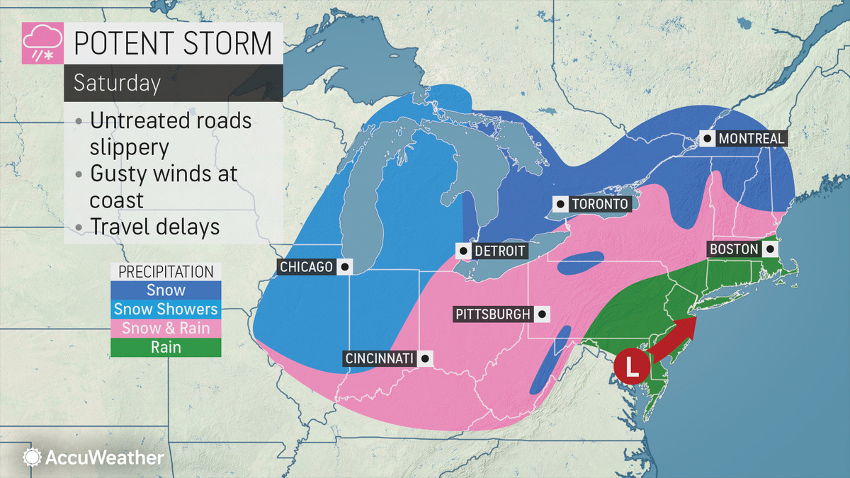
Weekend's Looking Warmer But Will Bring Mix of Snow & Rain
Can you BELIEVE the snow in Newfoundland?! https://t.co/3FoBJX2Tgq
— Christina Erne (@ChristinaErne) January 23, 2020
As far as snow totals go for our Saturday storm, warmer air looks to keep totals down. pic.twitter.com/joKtxEDGQc
— NWS Albany (@NWSAlbany) January 23, 2020
Reminder to stay tuned as we get closer to the weekend with warmer trends for Saturday. Warmer+wetter & a fast mover= rain, sleet & mix with some snow possible northern Adk's? Looks to lift north by midnight-1AM Sunday. Sure a little messy but better by next week! pic.twitter.com/kj2LXU62sg
— Jess Briganti (@JessBriganti) January 23, 2020
Another symptom of our warming winters, cold snaps are getting shorter and less cold over time. So far this winter our longest consecutive run of colder than avg. days stands at 5. Conversely, we've had a 17 consecutive day run of warmer than avg. days. pic.twitter.com/1UMj7P9HWS
— Steve LaPointe (@CBS6Steve) January 22, 2020
Going forward, no one day is brutally cold... kind of abnormal for the dead of winter! Warmer trend means weekend system will likely bring rain/mix for Albany and the valleys. Higher chance for accumulating snow in the hills and mountains pic.twitter.com/jI8NLeuy11
— Matt Mackie (@MackieMet) January 23, 2020
Tags: weather,