
Snow or Rain, But Definitely Wind, On the Way

SNOWFALL Map.....6pm
— Steve Caporizzo (@SteveCaporizzo) February 25, 2020
Latest data shows a VERY tight Gradient of no snow to heavy snow as you go North and west...esp WEST of Lake George and just north of Gloversville will have the greatest threat.
Also the mountains of Southern Vermont northward...esp above 1800 feet..... pic.twitter.com/yHgyalINAB
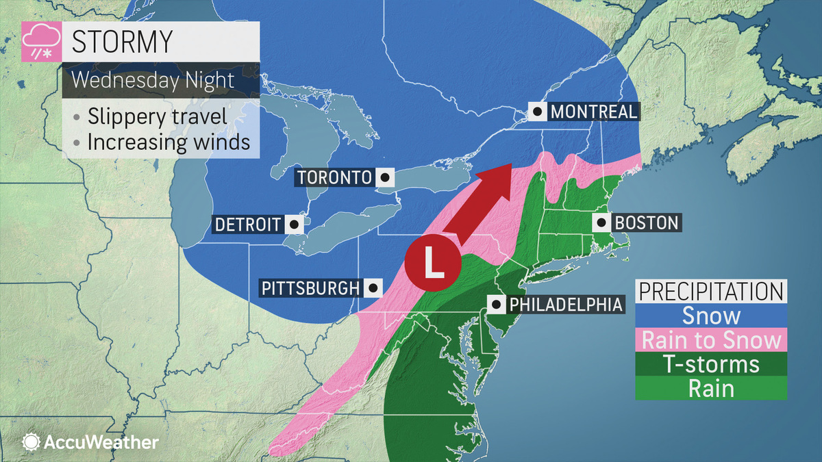
Colder air returning will allow for rain to change over to snow for Wed Night into Thurs. Winter Storm Watch issued for the Adirondacks & southern Greens with over 7" possible for the highest terrain. pic.twitter.com/R4I2Skj2G4
— NWS Albany (@NWSAlbany) February 25, 2020
Blizzard Warning for northern Herkimer & Hamilton Counties goes into effect 10AM tomorrow to 4PM Friday. Combination of heavy snow & strong winds will lead near whiteout conditions and very difficult travel conditions esp for areas north of Route 28 in the southern Dacks. #nywx pic.twitter.com/Eloq841zbz
— NWS Albany (@NWSAlbany) February 26, 2020
Rain, strong winds, then maybe a brief period of snow tonight into Thursday. Hill towns have the better chance for accumulations, as usual. Delays or cancellations unlikely. https://t.co/y9ixKbEg7r
— Greylock Snow Day (@GreylockSnowDa1) February 26, 2020
Tags: bad weather,