Looking Back at Irene: Road Woes
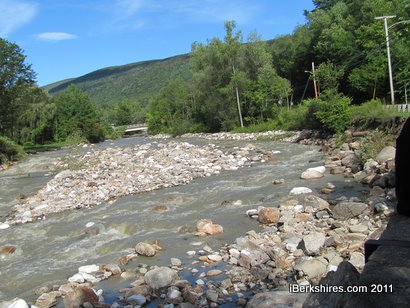
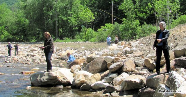

When the Briggsville Dam was removed in early 2011, the town envisioned a quiet place for picnics, fishing and watching the North Branch gently glide by.
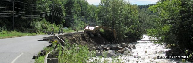
That all changed when Irene blew into town and scoured an extra 3 feet out of the carefully crafted riverbed and wiped away the picnic area and a good chunk of the banking along the old Strong-Hewat mill building.
Oh, and took out about 100 feet of Route 8.
Michael Canales, the town's former adminstrator and emergency management director, thinks it could have been worse.
Not too many years before, a swollen river had overflowed the banks near the dam and spread to the foundations on nearby Carson Avenue and took out the parking lot at what's now the Cascade mill. An image from 1948 show the river spreading to River Road as well.
If the dam was still there, said Canales, "I think you would have seen major damage to the houses in that area, and houses on Carson Avenue and the mill - instead of the damage happening to the banks of the mill it would have happened to the mill itself."
Still, the small town and its hardworking town officials, volunteer firefighters, police and highway crews spent a long day trying to avert floods and block off dangerously undermined roadways.
Canales remembers getting on the road around 6 a.m. to check the town; by 9, the emergency command center was fully staffed and activated at the fire station.
"It was about 8 when the calls started coming in, and then things started to rapidly go downhill," he said. "The big call came a little after noontime that River Road is vanishing."
Every pump was deployed, every piece of equipment on the road. When they weren't pumping out basements, they were at the highway garage filling thousands of sandbags. And watching roads disappear.
"It was just constant," said Canales. "You never felt like you were on top of things, just things were continuing to go and go. ... as soon as you got a crew back — dry them off, get some food into them, and where're they going next."
The major impact would be damage on River, Daniels and East roads. The start of school was delayed because bus routes had be redrawn and town officials focused on getting Daniels Road open as a priority. The state would step in to repair River Road, which cost about $10 million.
But even as residents on the east side of the river were forced to make long detours to get there from here, Clarksburg became a major connector in getting materials to and from Vermont, which was hit far worse by the storm.
The final repairs — to the East Road Bridge and Gates Avenue — should be completed this fall. But the configuration of the river, where the old dam had been, will be a potent reminder of the power of water.
"I remember standing up on the hill and watching somebody up near the river, on the other side where the old mill is, taking photos and not realizing that the banks all around him were collapsing," said Canales. "We were waving our hands trying to get his attention ... a tree to the person's left fell into the river and the guy started running away from the edge of the river."
It was with relief that they watched him retreat from danger; if he'd fallen, there was little that could be done.
"When the rocks are hitting the river so loud you swear it's thunder you know that that water is moving," said Canales.