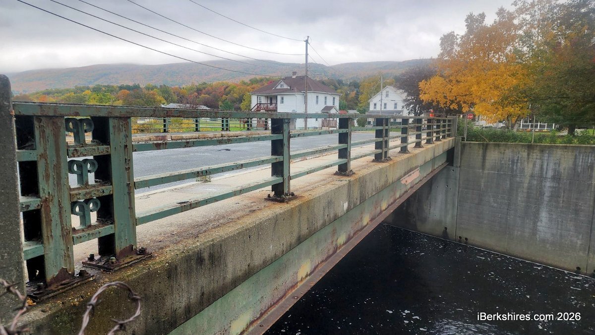
Adams' Cook Street Bridge Slated for Replacement
ADAMS, Mass. — The deteriorating Cook Street Bridge is slated for improvements, with the state favoring a superstructure replacement that would address the bridge's structural needs while minimizing impacts to the surrounding area.
The Cook Street Bridge primarily serves local traffic, spanning the South Branch of the Hoosic River and providing connections between the Ashuwillticook Rail Trail, Albert Street and Crotteau Street. It has a 12-ton weight limit.
The estimated cost at this point is $6.1 million.
The single-span bridge, originally constructed in 1957, has developed several structural deficiencies in recent years, including deteriorating steel beams with section loss and rusting, said Kasey Burke, project manager for the consulting engineering firm TEC.
Additionally, there are holes in the underside of the deck that have exposed rebar, which is restricting travel across the bridge, she said.
Deterioration of the bridge deck beneath the pavement is also resulting in several potholes on the road surface, which presents an ongoing maintenance issue for the town, Burke said.
The planned replacement will have 10-foot striped travel lanes in each direction and be the same length of the current bridge, without adding any extra supports.
The vertical and horizontal alignments will be similar to existing conditions. The new superstructure is planned to have a steel plate girder, a concrete deck, and crash-tested concrete bridge railings. The project will also upgrade the ramp and crosswalks at the bridge approaches with Americans with Disabilities Act compliant ramps.
There will also be striped crosswalks at the intersections of Cook and Crotteau Street and Cook and Albert Street.
The current bridge's continued deterioration was the driving force that prompted the state Department of Transportation to establish the replacement project in November 2024.
Since then, MassDOT has completed surveys and site investigations and has approved the bridge type, and the consultant's 25 percent design plans have been submitted and reviewed, Burke said.
When MassDOT indicated it would approve the project for funding, the town of Adams accepted responsibility for acquiring the necessary rights in private and public lands for the project's construction, maintenance, and public use, said Zachary Feury, of MassDOT's municipal right-of-way team.
The tentative construction date is summer 2028. The project's 75 percent design is expected in early 2027. Then the right-of-way process will begin and the consultant will submit its 100 percent design.
Following which, the state will be able to advertise the project for construction in spring 2028, said Dongke Yu, MassDOT project manager.
During construction Cook Street will be fully closed. Vehicles, pedestrians and bicyclists will be detoured to nearby roads. The construction will be phased so utilities can remain in service. Property owners will continue to have access throughout construction, including access to Albert Street, Burke said.
Construction is anticipated to take about two to three years, depending on the contractor and the coordination with the town, Yu said.
The aim of the project is to address the bridge's aging infrastructure to ease the maintenance concerns by constructing a minimal maintenance structure and code-compliant traffic safety features over the bridge and at its approaches, Burke said.
Additionally, sidewalks will be built that connect to the area's existing sidewalks and five-foot bicycle lanes installed in both directions, she said.
"Setting these project goals provides a framework for the rest of the project and allows the design team to generate appropriate alternatives to consider," Burke said.
The two main alternatives considered for the project were the proposed superstructure replacement and a full-bridge replacement.
The superstructure replacement would include new beams, a bridge deck, sidewalks, railings, curbs and other components above the abutments, constructing the new superstructure on top of them.
Burke said this option would allow the existing abutments to remain in place, preserving the U.S. Army Corps of Engineers flood walls.
"Any alteration to these flood walls would require USACE approval, which could result in significant permitting and advertisement delays," she said.
The preliminary structures report shows that the flood walls were evaluated and determined to be adequate enough to remain in place and support the new bridge superstructure, she said.
"Minor repairs to these flood walls are recommended to extend their service life," Burke said.
A full bridge replacement would require replacing of the existing flood walls and the superstructure resulting in "substantially greater impacts to the Hoosic River channel and adjacent properties," she said.
It would also require additional permitting and increase the complexity of the construction, Burke said.
Tags: bridge project, MassDOT,