
Four Storm Systems Bringing Slippery, Sleety Weather to Berkshires
#OTD in #SNE Weather History:
— NWS Boston (@NWSBoston) February 4, 2020
2/4/1961: Blizzard which brought >1 ft of snow & wind gusts >90 mph to parts of #SNE.
2/4/1995: The only significant winter storm of the 1994-95 winter began today! pic.twitter.com/pwbt2x84wJ
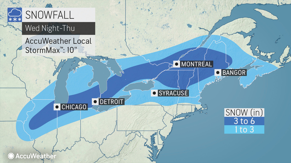
If this @NWSAlbany forecast comes through, we might see delays on Thursday. pic.twitter.com/alo27j4KZh
— Greylock Snow Day (@GreylockSnowDa1) February 4, 2020
Our next system moves in Wed night through the first part of Thurs... Snow/sleet amounts look to remain low in the immediate Capital Region with higher amounts of 2-4" likely through the Green Mountains & into the Adirondacks... Round 2 comes in Thurs night into Fri... pic.twitter.com/LMJkYChM3C
— Rob Lindenmuth (@RobLindenmuthWx) February 4, 2020
TONIGHT: Mostly cloudy....drier air by morning....a slightly colder air.
— Steve Caporizzo (@SteveCaporizzo) February 4, 2020
WEDNESDAY: P.Sunny...sunnier north.....colder, more seasonable day.
Snow/Sleet arrives 10pm to Midnight...Messy Thursday Morning. pic.twitter.com/RM0MFgNE1C
Tags: bad weather,