

Snow, Sleet Incoming for Berkshire Region; Prepare for Messy Commute
Wednesday will be precipitation free then snow moves in after midnight. Delays and a few snow days expected on Thursday. https://t.co/rX5mNtreko
— Greylock Snow Day (@GreylockSnowDa1) February 12, 2020
Expect a slippery Thursday morning commute as a period of snow leaves behind 1 to 4 inches of snow tonight throughout eastern NY/western New England. Freezing drizzle lingers in the higher terrain. See our winter weather advisory for details. #nywx #ctwx #vtwx #mawx pic.twitter.com/oTmLeqKSYl
— NWS Albany (@NWSAlbany) February 12, 2020
NEW DATA IN...
— Steve Caporizzo (@SteveCaporizzo) February 12, 2020
Still confirms a FAST moving Storm (8-12hrs)....quick burst of snow...changing/mixing with rain
by Thu 7am-Saratoga South.
Narrow band of 4-6" S.Adirondacks....across to Lake George and the Mountains of New England...few spots 6" +
Conditions will improve quickly pic.twitter.com/t8rEa6IoCC
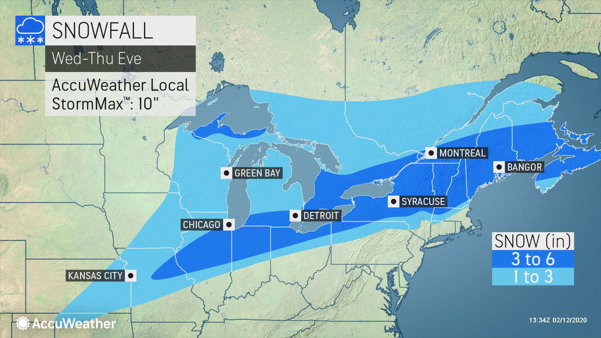
A storm system will put down a swath of heavy snow from the Plains to the Northeast. A look at accumulations and timing: https://t.co/Z7krWu5qAJ pic.twitter.com/syz0fPrTBt
— WeatherNation (@WeatherNation) February 12, 2020
On the cold side of the heavy rain event which will impact the South through Thursday, a relatively narrow stripe of light to moderate snow will impact portions of the Great Plains into New England. pic.twitter.com/HzHmLHqER9
— NWS WPC (@NWSWPC) February 11, 2020
Tags: bad weather, snow & ice,