State Reallocating Resources West as Henri Changes Track
The National Weather Service reports that Henri has strengthened to a hurricane as it continues to head northward off the East Coast. The storm is expected to make landfall near Long Island or southern New England on Sunday, then weaken rapidly as it heads across Connecticut on Sunday evening. The
storm will continue to slowly exit the region on Monday.
There remains uncertainty in how far west Henri will track and how strong it will become before making landfall. The main hazards include damaging winds and flooding rain.
"The new forecast also calls for significant rainfall Sunday into Monday, especially in Berkshire County, the Connecticut River Valley and Worcester County. And the likelihood of flash flooding and washed out roads are a distinct possibility in these areas, especially given all the rain we've seen in July," said Gov. Charlie Baker during an update on Saturday afternoon. "Given the new storm track, we won't be calling up any additional National Guard assets or personnel.
"The assets we currently have are moving closer to Western Mass to assist there or Central Mass if they're needed there. State Police will also be redeploying their extra teams to those areas as well."
Baker has activated 1,000 guardsmen to assist emergency responders when Henri looked to hit just west of Boston. While the situation for Cape Cod and southeastern Mass has improved, there is still a warning of storm surges, heavy rain, wind and flooding.
The governor said he and his team had been on a call with President Biden, Federal Emergency Management Agency Administrator Deanne Criswell, and Northeast governors about the pending storm.
Massachusetts Emergency Management Agency Deputy Director Pat Carnevale said the storm has been "dynamic" and changing over the last 24 hours.
"What we're seeing here is this storm has been all over the place at this point," he said. "So it started out in the west last night, shifted a little bit to east. So we have to be prepared as the storm still is trying to move around."
Carnevale, a Western Mass resident, said the flood risk must be taken very seriously "especially given all the rain we've had back in July."
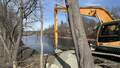
Western Mass and northern Worcester County were greatly impacted by some flooding, he said, and MEMA was doing assessments on that when preparations had to begin for Henri.
"So, the rain that they've already received plus this rain will be a definitely an impact of Western, Central Mass," Carnevale said. "Many of us have dealt with flooding associated with Tropical Storm Irene in 2011."
Ten years ago, Irene caused massive flooding through eastern New York, Western Mass and Vermont.
In a CodeRed message, North Adams Mayor Thomas Bernard said city officials are working with the Northern Berkshire Emergency Planning Committee to monitor and respond to conditions and inform the public.
Residents are being asked to prepare for potential power outages by having devices charged and flashlights handy. People are being asked to limit travel during Sunday and Monday when the storm will be at its height.
Eversource says it will have more than 1,100 crews in Massachusetts to restore power to customers.
Baker said the main concerns for Massachusetts are power outages and localized flooding. Drivers, if they must go out, are cautioned to avoid floodwaters which can be deeper than they look and conceal hazards.
"There's still the possibility of widespread power outages in just about every part of the commonwealth," said Baker. "Due to high winds and the heavy rain across Massachusetts, we will likely see tropical storm force winds, which will be somewhere in the vicinity of 40 miles an hour on a sustained basis throughout tomorrow. Regardless of wherever you live, even if you don't normally lose power in a storm you should be prepared to deal with the possibility."
Tags: bad weather, hurricane,