Cold Blast to Start the Weekend, Snow Expected to End It
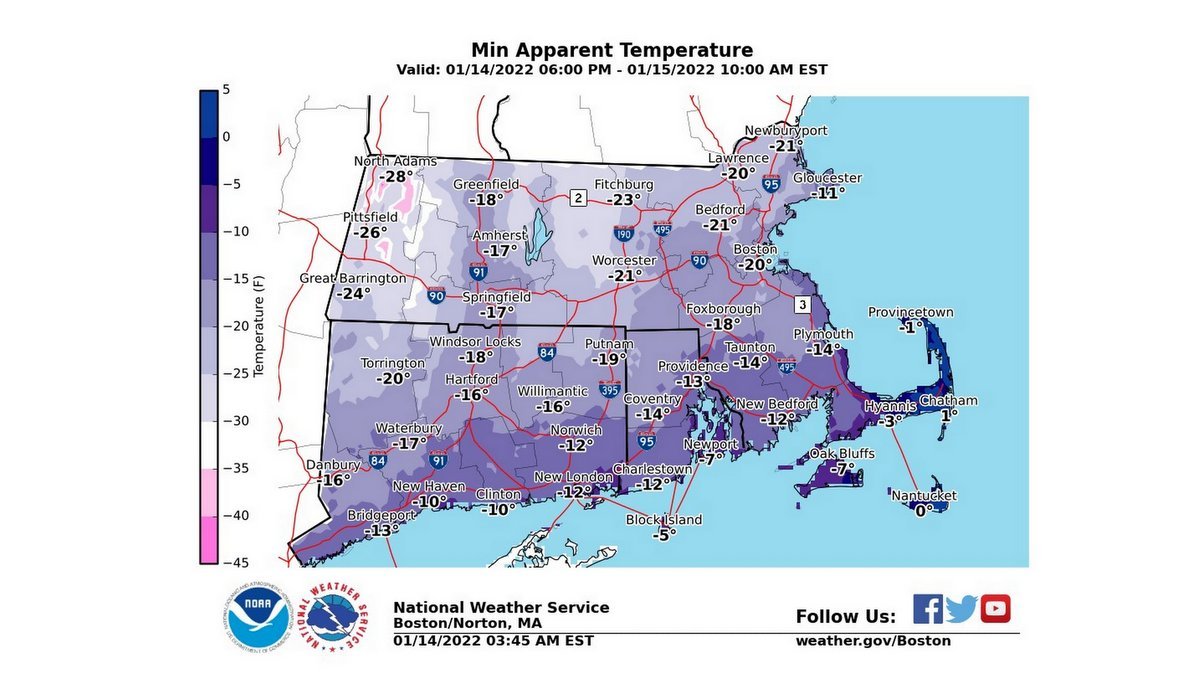
Wind chill advisories and warnings up region-wide heading into tonight/tomorrow morning. Wind chills will range from 10 to 40 below! 🥶 pic.twitter.com/9jjzzQhbay
— Alyssa Caroprese (@CBS6Alyssa) January 14, 2022
- No vehicle is permitted to park or stand unattended upon any street, highway, traveled way, or public parking lot during a storm emergency.
- No vehicle is permitted to park or stand unattended on any open municipal parking lot during a storm emergency permitting the lot to be effectively cleared of snow.
Way to early for specifics for next Monday... still a lot of spread in the computer models, but you can see that shift northwest today, which would bring more rain to SNE and snow north and west. #WBZ pic.twitter.com/YLgUaaf4IQ
— Sarah Wroblewski (@sarahwroblewski) January 12, 2022
Extremely Low Winds starting Friday night.
— Steve Caporizzo (@SteveCaporizzo) January 14, 2022
Please be careful.....Be sure your pets are INDOORS.....and if you see a pet in distress....please try to help them or notify authorities. pic.twitter.com/vTe3jPIuyt
What a #weather sequence coming up --
— Stu Ostro (@StuOstro) January 14, 2022
➡️Meteorological bomb over Atlantic
➡️Helps pull down Arctic high behind it w/cold air damming
➡️Energetic mid-upper system sweeps into that
➡️Potent low-level jet also ensues
👉Result: Wild cyclones 🌬️🌊 & wintry mess 🥶❄️ pic.twitter.com/DhyPXjzJRP