Dalton Air Quality Report Links Dust to Digsite
DALTON, Mass. — For more than a year, neighbors of Berkshire Concrete's unauthorized dig site have complained that sand drifting into their neighborhood is affecting their air quality.
A five-month study is providing data that may support these claims.
Air Partners Collaborative of Needham monitored the air quality over five months — from October to April — using a network of monitoring sensors at strategic locations surrounding the site.
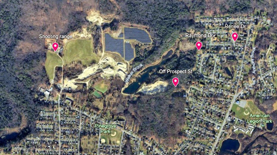
Sensors were positioned west and southeast of the site at four locations: Raymond Drive, Off Prospect Street, Renee Drive, and the shooting range 80 meters northwest of the site to provide background measurements for the northwesterly winds.
During the observation period, it was determined that Dalton is experiencing "extreme events of coarse particulate matter, with an aerodynamic diameter of 10 micrometers (PM10)
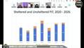
The National Ambient Air Quality Standards for PM10 is 150 micrograms per cubic meter within a 24-hour period, the report says. But Dalton is seeing concentrations reaching 1,000 to 10,000 micrograms per cubic meter during individual events. This is seven to 67 times the national standards.
The wind direction analysis indicates that 10 of the 12 exceedance events, or 83 percent, suggest the digsite may be contributing to the issue, but this cannot be proved with certainty.
Six of events, 50 percent, show the digsite had "clear, unambiguous" influence over the peak events, while two days, 17 percent, can be attributed to other sources.
The report said these events are consistent with wind-blown dust from exposed, unvegetated soil and "are diagnostic of fugitive dust from unpaved, exposed sand surfaces, not combustion or regional transport sources."
If this trend continues, the town is expected to exceed the PM10 National Ambient Air Quality Standards for 2026, the report said.
"The current rate of 12 exceedances in five months — during a period of relatively low
mine activity and partial snow cover on exposed surfaces — far exceeds the allowable rate of no more than one exceedance per year under federal standards," the report said.
The report says the variability in which the sensors record the most exceedance events is worth further investigation as Raymond Drive records the strongest PM10 levels with clear digsite influence, while Off Prospect Street records smaller or no levels.
"Community partners have suggested that local topographic and meteorological factors may reduce the representativeness of the Off Prospect Street sensor under certain conditions — an observation that merits further analysis as the monitoring record grows," the report says.
As monitoring continues, Air Partners Collaborative will continue to collect data and a full annual attainment assessment will be conducted following state Department of Environmental Protection methodology.
Further analyses will also include additional statistical measurements on the influence the dig site has on air quality, with refined source attribution for events with mixed wind signals, and — where possible — comparison of PM10 levels during periods of active mining versus passive wind erosion.
Future analysis will include additional statistical measurements, aim to better separate pollution sources when winds are mixed, and compare, where possible, PM10 levels during active mining with times when dust is only caused by wind.
Dalton Air Quality Report by iBerkshires.com
Tags: air quality, dust, debris, lawsuit,