Three Projects Could See Revitalization Across North Adams
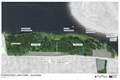
An illustration by designers Reed Hilderbrand landscape architects of the pathway of the proposed North Adams Adventure Trail bike and pedestrian path.
The city has three major projects in the works that would improve connectivity in the community, relieve traffic confusion and congestion, and create more recreation opportunities.
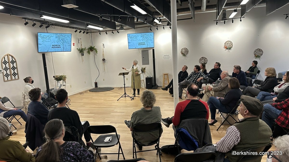
Residents learned about the history, hopes, and timeline of three projects: North Adams Adventure Trail, Hoosic River Revival, and Reconnection Communities Pilot, during a recent forum organized by the Northern Berkshire Community Coalition.
During each of the three presentations, each of the project leaders demonstrated how the city's current design is out of date, confusing, disjointed and dangerous.
Each of the projects have gathered information from the community through interviews, collaborations, listening sessions, and historical reviews.
The project leads have been and will stay in communication with each other throughout the development of these projects to inform designs and create a system that fits the future the community wants to see.
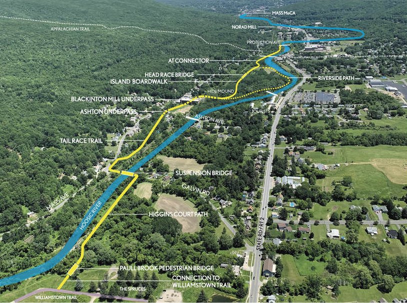
North Adams Adventure Trail advocate Eric Kerns demonstrated in his presentation that a bike trail that connects Williamstown to North Adams is not only essential but is a game changer.
Having a multi-use nature path connecting Clark Art Institute, Williams College, Massachusetts Museum of Contemporary Art, and downtown North Adams would be an internationally unique situation, Kerns said.
"There's nowhere else in the world where you could come to Mass MoCA or downtown North Adams, rent a bike, ride through the woods along the river for a half an hour, and arrive at another world class artists destination. That is a game changer for this region," he said.
The bike path will connect with the proposed one-mile stretch from Galvin Road and the 2.5-mile section currently being constructed in Williamstown from North Street to the Spruces Park.
The community has wanted a bike path that connects North Adams with Williamstown dating as far back as 1896 when it was reported in the former North Adams Transcript.
After navigating obstacles surrounding narrow sections of the valley and current infrastructure while also being mindful of projects in development, organizers are confident for the first time there is a viable route between the town line of Williamstown and Protection Avenue, Kerns said.
In an effort to determine how this bike path would work and why it wasn't working, Kerns interviewed a number of people from former city planners to City Council members.
What he found was that everybody had a different idea for why it wasn't working and that those involved in decision making, at no fault of their own, don't ride bicycles.
During the forum, community members agreed that riding a bike between Williamstown and North Adams on Route 2 was unsafe.
North Adams is the missing link in the larger regional system that would connect Williamstown, North Adams, and eventually connect with the Ashuwillticook Rail Trail.
The vision of a bike path across the length of the county has been a goal for many years. The Ashuwillticook Rail Trail runs from the Berkshire Mall to Lime Street in Adams and a Pittsfield leg is also now under construction.
The 3.3-mile stretch would cost about $6 million to design and engineer.
During the meeting it was clear that urban revitalization came through the city like a "blunt instrument."
"I'm not here to judge the decisions of the past based on information that we have now with hindsight on our side," said Jenny Wright, head researcher for civic infrastructure and community engagement
on MoCA's Placemaking Task Force.
Urban renewal in the 1960s and '70s was a "top-down decision made by the federal government to get rid of old structures" that were blighted and dangerous in an effort to make way for new things, she said.
The result of these changes was the prioritization of cars over people, resulting in the buildings that were torn down being turned into parking lots.
"You can see the impact of that because there's not a lot of walkable area, you can see that most of those lots are now parking lots instead of buildings where people live," Wright said.
Wright quoted Frances Sebastino, who was interviewed in Joe Manning's "Disappearing Into North Adams," in which she said, "When they started the urban renewal, I don't think anybody thought they were going to rip down half the city."
The changes caused by urban renewal resulted in poor street and sidewalk connectivity and navigation confusion for non-North Adams-natives, which was indicated in the Vision 2030 Plan, developed early last decade.
The Reconnecting Communities Pilot Program is aimed to solve some of the problems caused by urban renewal.
"This infrastructure law acknowledges that there was a lot of harm done to neighborhoods during urban renewal," Wright said.
"... This opportunity is different [from urban renewal] because that funding is available, the opportunities available, the mandate is there but it's up to communities to decide what their future looks like, and to ask for that funding to get them there.
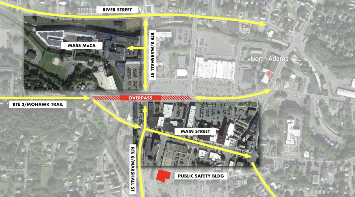
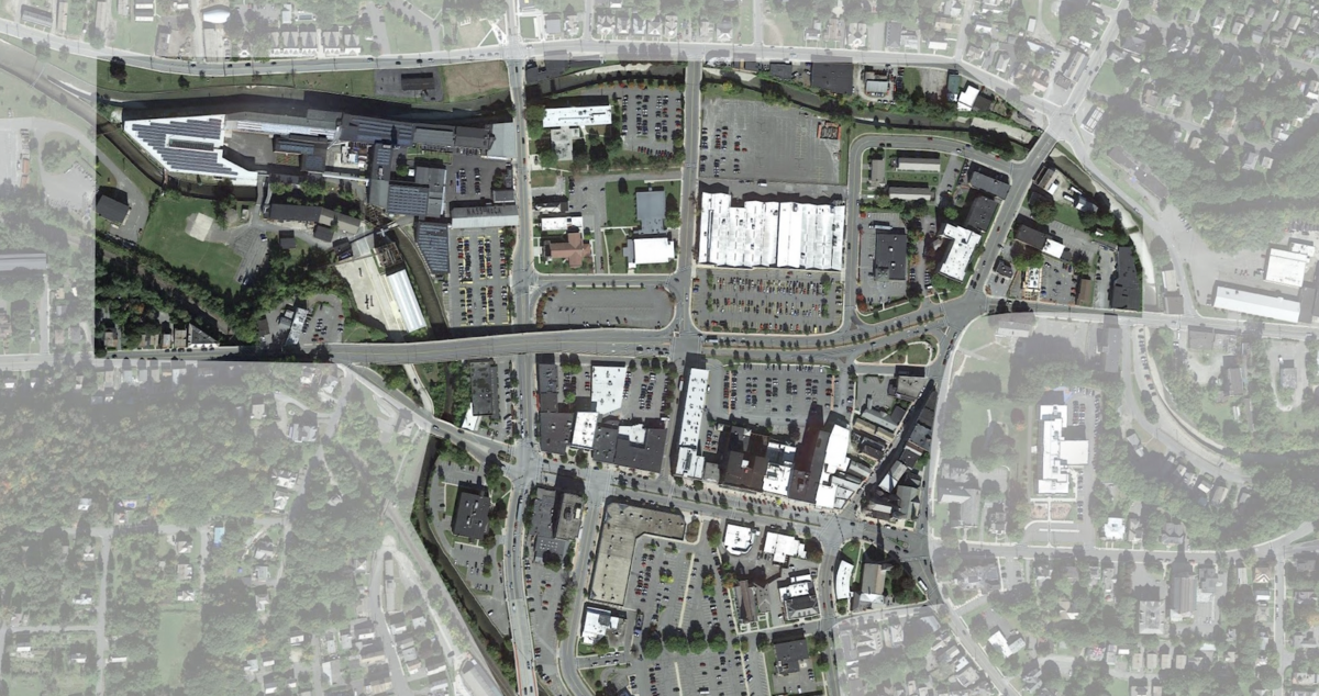
Some of that damage was the demolition to straighten out Route 2 that resulted in the massive and now structurally deficient Veterans Memorial Bridge and the plethora of parking lots between MoCA and Main Street.
The city was approved for a $750,000 grant from the federal government to study alternatives to the overpass. North Adams is collaborating with Mass MoCA on the feasibility study on how better to connect the two destinations and improve pedestrian and traffic flows.
"The money goes toward hiring a planning firm, to look at the whole picture, and then to consider what are some alternatives to this overpass so that the city can understand what the options are," Wright said.
The firm will not only look at existing needs of the community but will also consider projects in development when coming up with options.
Possible redesigns for the Hoosic River Basin Flood Control System were also presented during the forum.
The flood control chutes were constructed in the 1940s and 1950s by the Army Corps of Engineers to prevent the destruction and loss of life in North Adams after a number of devastating floods.
While it's done its job well, the structure's age and below par construction is starting to show as five of the 20-foot concrete panels have collapsed into the river over the past decade or so, including by the $65 million Building 5 at Mass MoCA. Most have been repaired or jury-rigged. In addition to that, nine of the structures are leaning.
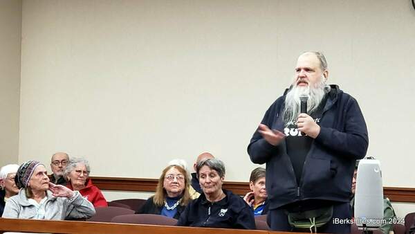
"The city of North Adams along with the Hoosic River Revival has done research and has come to the conclusion that failure of the city flood chutes or dams would be catastrophic and it's a high priority," river advocate Judith Grinnell of the River Revival said.
Revamping the outdated control system would not only prevent flooding but also enhance the aesthetic appeal, and provide recreational benefits.
Traditionally, flood control systems have narrow high walls that are an eyesore. A possible option to consider is to have berms and levees which are wider and use grass, not concrete.
Another alternative is to take inspiration from what was done in Denver, where a low-flow channel was constructed that is 40 feet wide and has walking paths for residents.
In addition to that, the $3 million feasibility study underway now can consider using rocks or stones so that when there is a flood the water goes to the top and comes back down but residents still have access to the channel.
Grinnell also demonstrated how improving the look of the flood control system would attract people by referencing the 2008 Light Festival.
Upwards of 3,000 people came the "banks" of the Hoosic River to see the lights. The light festival included impressive "bridges" of light across the flood control chute's 45-foot span.
The project is in the very early stages of the three-year study through the city, state, and federal government, Grinnell said.
Tags: bike path, bridge, flood control, Hoosic River Revival, urban renewal,