If you would like to contribute information on this article, contact us at info@iberkshires.com.
Your Comments
iBerkshires.com welcomes critical, respectful dialogue. Name-calling, personal attacks, libel, slander or foul language is not allowed. All comments are reviewed before posting and will be deleted or edited as necessary.
No Comments
Dalton Day Returns This Saturday
By Sabrina DammsiBerkshires Staff
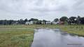
DALTON, Mass. — The town's popular Dalton Day festival is returning this weekend after a year's hiatus.
The event will kick off this Saturday at 11 a.m. and runs until 4 p.m. in the field in front of the Senior Center.
The community celebration was established in 2023 by the Cultural Council in an effort to increase resident participation at town meetings while also showcasing the area's welcoming, diverse, artistic and sporty atmosphere. In 2024, the event brought together 300 residents.
"The primary mission of Dalton Day is to foster a strong sense of community, build civic pride, and bring residents together through a shared celebration of local culture, music, and food," said Jeannie Ingram, Select Board member and cultural council chair, and Lori Venezia, executive assistant to the town manager.
The event provides an accessible and free platform for "civic education, community bonding, and supporting local businesses, artisans, makers, and culture more broadly," they said.
The festival strengthens the fabric of the town both civically and economically by connecting grassroots organizations with residents, fostering a shared sense of belonging, and providing free, family-friendly entertainment.
It also serves as an opportunity for community members to meet with local officials and a couple of state officials. State Sen. Paul Mark and state Rep. Leigh Davis will be coming from Beacon Hill to speak at the event.
Check out the events happening this Fourth of July weekend, including America’s 250th birthday celebrations, fireworks, hikes, and more. click for more
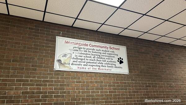
The Pittsfield Public Schools granted around 60 intra-district and school choice requests for the upcoming academic year without Morningside Community School. click for more
In honor of the 250th anniversary of the United States, a fireworks display is scheduled for Wednesday, July 8, at 9:15 p.m. in the area of Wahconah Park. click for more
Healey was joined by local and state officials for a tour of Berkshire Family YMCA and Girls Inc. of the Berkshires in Pittsfield to celebrate investments in child care assistance programs aimed at making child care more affordable across Massachusetts. click for more