Winter Weather Advisory for Northern Berkshire; Snow on the Way
Rain for most, a few snow showers for the Berkshires.
— Jacob Wycoff (@4cast4you) November 26, 2021
My latest forecast --> https://t.co/1Gn7a6EOMr pic.twitter.com/yEi2SgDR9X
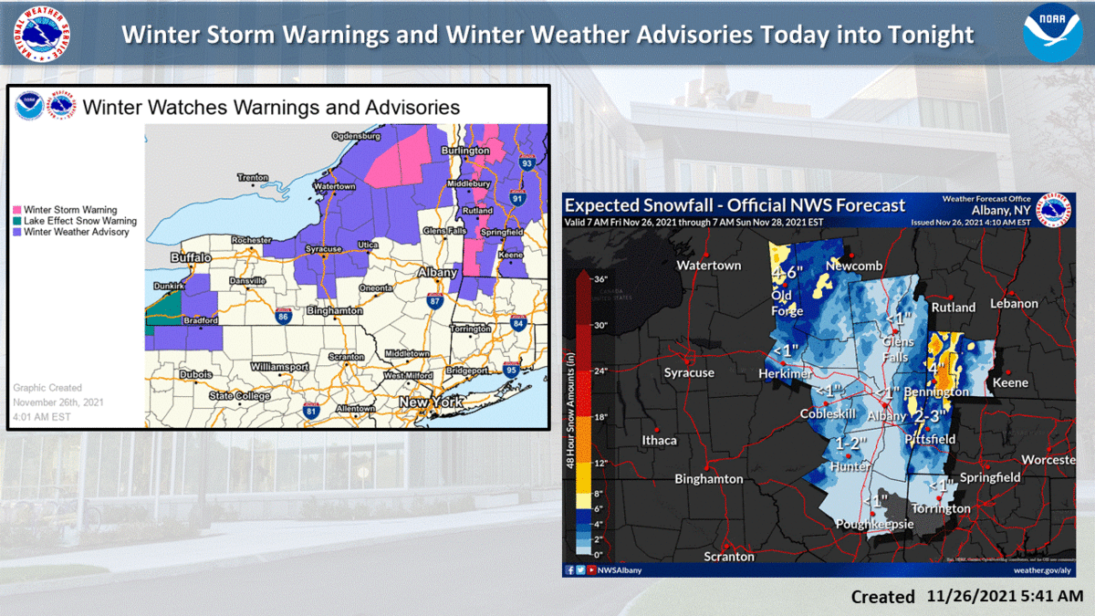
As we continue into the holiday weekend, the first significant snowfall is in the forecast across portions of New England. Here is the latest regional snowfall forecast as of Friday morning. Be sure to check https://t.co/VyWINDBEpn for your local forecast. pic.twitter.com/wZIiFLsAOk
— National Weather Service (@NWS) November 26, 2021
Heads up everybody - accumulating snow expected over the higher terrain today and tonight. Accumulations will vary but the highest amounts will be over the peaks of the Green Mtns and will exceed 8" for some. Some valley areas could end up with a trace to a dusting. pic.twitter.com/mevsfI8L07
— Alyssa Caroprese (@CBS6Alyssa) November 26, 2021
Those heading home from short holiday trips or getting an early start for holiday shopping should exercise caution: https://t.co/3TwF5TxIUZ pic.twitter.com/4czIy0EbZE
— Breaking Weather by AccuWeather (@breakingweather) November 26, 2021
First Snow Of Season Possible For Boston Area Friday Evening (via @4cast4you ) https://t.co/sGnCK7uVyE pic.twitter.com/Z0wLVJ6xbF
— WBZ | CBS Boston News (@wbz) November 26, 2021
Current radar picture ... a change to snow will take shape over the Catskills and Adks the next few hours. pic.twitter.com/2wcRJwDB4N
— Alyssa Caroprese (@CBS6Alyssa) November 26, 2021
Tags: snowstorm,