Pittsfield Parks Commission Backs Pontoosuc Access Plan
PITTSFIELD, Mass. — The city has devised a solution for the south shore of Pontoosuc Lake Park that increases access while protecting the bank from erosion.
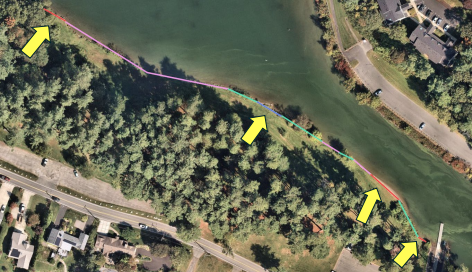
On Tuesday, the Parks Commission endorsed a plan for four easy-entrance points after community members asserted that bank plantings limited access for fishing and swimming. It will be sent to the Conservation Commission, which will consider modifying the project's permit.
The plan proposes 150 feet of live stake planting removal on the 940-foot stretch of shoreline.
"I think it's important to state that the Pontoosuc Lake Park shoreline has always been accessible. There has been no attempt to limit access," Parks, Open Space, and Natural Resources Manager James McGrath said.
"The bank plantings that were put in were a response to an overwhelming concern with erosion."
The map proposes four access areas, one of which is existing. McGrath reported that stakes were vandalized and removed "almost immediately" near the boat ramp.
"There's nothing to remove there. It's been removed. It was vandalized," he said. "But we're suggesting that that area next to the boat ramp stay open, and that is an unfettered, easy access, where no one's going to feel like they're touching any shrubs."
More than 280 feet of existing vegetation and about 450 feet of severely eroded areas treated with additional plantings would not be touched. McGrath pointed to the "very significant" stretch of 450 feet in front of the old beach area that has seen the most soil loss over time.
"And in fact, it's almost arcing, whereas old GIS and aerial photographs show that the bank, at one point, was almost linear across, but now it sort of has this arc to it where there's been this constant erosion," he said.
This plan is said to respond to erosion by not compromising work that has been done on the most unstable part of the bank.
McGrath maintained that the entirety of the lake's shoreline is available for anyone who wants to "traverse through it, over it in a lawful way and access the water." He pointed to the western property boundary, where there is "ample" opportunity for access, as well as the north side of the channel.
"So when folks are saying that there's no access onto the lake from Pontoosuc Park, that's just not true," he added.
Commissioner Cliff Nilan said this is a good compromise and underscored the meetings held on the project that date back to 2021.
"This is something that we gave a lot of thought to through numerous public meetings and Parks Commission meetings," he said.
"At the last minute, the fishing came forward. We didn't hear anything about fishing out of all these meetings, but I think we've compromised in the last minute. I think it's a good compromise, and I think Jim deserves a lot of credit for getting this project through, getting money for it, and following through."
The project is part of a long-range open space and recreation plan for the city developed in the early 2000s, and a master plan endorsed by the commission in 2022.
This southern area is being targeted for passive recreation, with the north side encouraged for swimming to protect resource areas and reduce conflict between swimmers and boaters.
Improvements to the south side include:
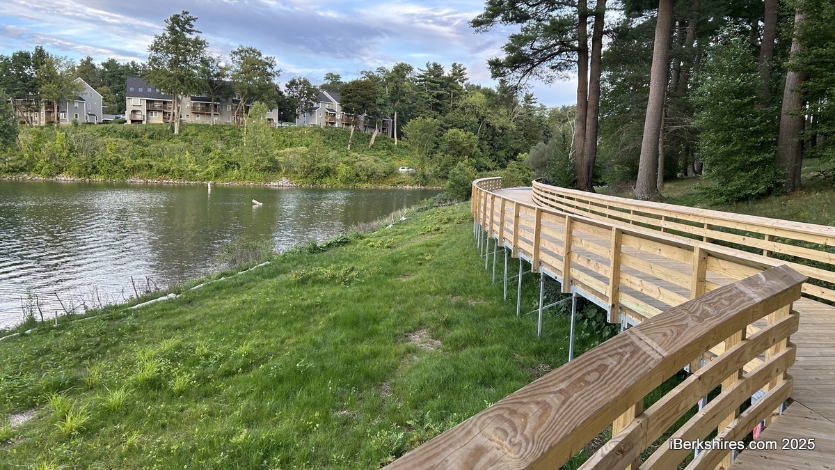
- transforming the current grass path to a paved promenade with a boardwalk around the wetland area
- a gathering spot and overlook
- improving the health of the white pine trees
- some clearing of the west side to improve the views
- repairing the upper parking lot
- adding an accessible path that will come down to the boat parking lot and connect to the accessible path
- benches and picnic tables
Tags: Pontoosuc, public parks, swimming,