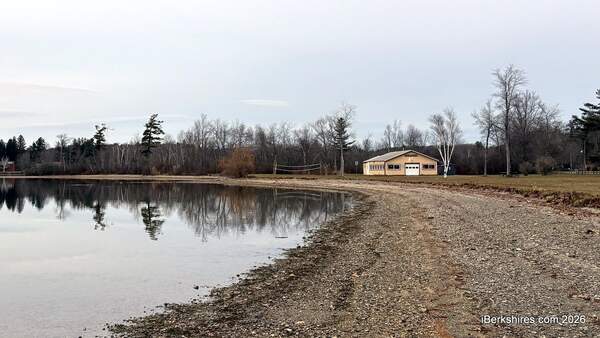
Pontoosuc Lake Shoreline Access Plan Tabled for Revisions
PITTSFIELD, Mass. — The Conservation Commission has requested another plan to improve access on the south shoreline of Pontoosuc Lake while stabilizing the bank.
Last week, a modified planting plan from the Parks Commission was tabled. The conversation is now centered on how to use alternative erosion controls from the shrubbery that was planted to balance stabilization and access.
"Moving forward, you're going to have to submit a plan to address the erosion and the issues," Chair James Conant said to Parks, Open Space, and Natural Resources Manager James McGrath, representing the city.
"If the issue is planting because people can't get in front of the plants to go fishing, I don't know exactly. I don't understand the whole thing. I still think there's access there to fish. But in any case, if we are not allowed to use planting to stabilize the bank, then we have to come up with another technique, and that's the responsibility of the applicant."
Commissioner Stephanie Storie added that it also impacts the ability to use the bank.
"A lot of what we looked at, you're not gonna be able to stand there without falling in the water either, even if we do want it to be able to be used for the recreational uses," she said.
"So stabilizing it benefits the lake and also the people that want to keep using it, because if that undercut continues, there's no fishing. There is not doing anything there."
The Parks Commission endorsed a modified planting plan in September after community members argued that shoreline plantings were impeding access for fishers and swimmers. Bank stabilization is part of a larger project to improve the park’s ecological and recreational facilities.
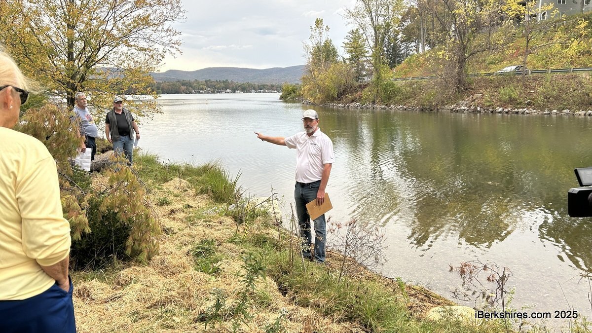
In October, the ConCom held a site visit on the southern shoreline in preparation to consider modifying its wetland permit. The plan endorsed by the Parks Commission proposed four easy access points along the nearly 1,000-foot stretch.
Resident Daniel Miraglia said this shoreline has been heavily used for recreational activities over the last 80 years.
"As far as looking at the issues at hand, I firmly believe that the project lacked a lot of things from the beginning, so I'm looking for a way that the commission could move forward to mediate, to allow an amendment to the order with an order of conditions attached, that speaks directly to allowing open areas of the lake to be used for fishing, access, for picnicking, etc, with a management plan for stabilization of the inland bank," he said during public comment.
"I’ve said it before, that to try to cluster plant the bank is probably the wrong idea for a shoreline in that particular area that takes high wind, and it takes constant boats going up and down. There are other ways to stabilize the bank, rather than cluster planting, and that's using a membrane or netting and meshing to encapsulate areas of the bank. So if an amendment could be placed that open areas would be allowed for access with bank stabilization in the plan."
He said the access area is within 50 feet of the boat ramp, and that the Public Access Board doesn’t allow fishing and swimming within that space.
"We've got one area that you agree upon that there's not an issue, but the shoreline is almost three football fields long, how do we gain some more access for the public to utilize, once again, a shared lake and a shared interest on a shoreline that belongs to the Commonwealth and the shoreline is equally shared by the Park Commission?" he said.
"So I'm just hoping that you guys can come up with something and approve the plan that's in front of you from the Parks Commission."
Commissioner Jonathan Lothrop said he would be okay if the first area, next to the boat launch, remained open because it is shallow and without much degradation. However, he said there was significant bank erosion in the other areas that need to be addressed.
"It's a bank stabilization plan, like that was the purpose of it. There were other things that were done, but at the end of the day, it seems to me like if we just let that go, we are undercutting what the intent of the plan was, ultimately," he said.
"I understand there are other concerns, and with this lake, as you well know, there are many uses. You can't swim in every spot, you can't boat in every spot, you can't fish in every spot, you can't walk in every spot. Primarily, our job is to engender water quality at this property, at this lake, at this facility."
Commissioner Thomas Sakshaug agreed.
"I think we need to have a plan to take care of those bank areas that are being eroded, whether that's heavy native stone or some biodegradable logs or something that will preserve that shoreline as much as we can," he said.
Conant added that the last site near the boardwalk was under "severe crisis" because of the erosion, and it is the commission’s charge to protect the quality of the lake and its water.
"This is still going to have to be addressed, and so the conversation will continue," he said.
Karen Kalinowsky, candidate for at-large councilor, said something needs to be done about the erosion, "but I also think that the lake has been used for years. I mean, I've lived here all my life."
"Not just for fishing, but for swimming. People walk their dogs and let their dogs swim in the area. It's very easy to access the water at this time," she said.
"I know there are plans to make a swimming area, but parents with small children would not be able to use it, because if you walk down those steps into the water, the water is at least my waist height, the last time I went in there. So somebody with a 2-3-year-old would not be able to access the lake at all."
Conant clarified that the ConCom is not the applicant for the plan, and the city will have to come forward with amendments for the commissioners' review.
Tags: conservation commission, Pontoosuc,