Clarksburg Officials Updated on Grant Projects; Input Sought on Town Playground
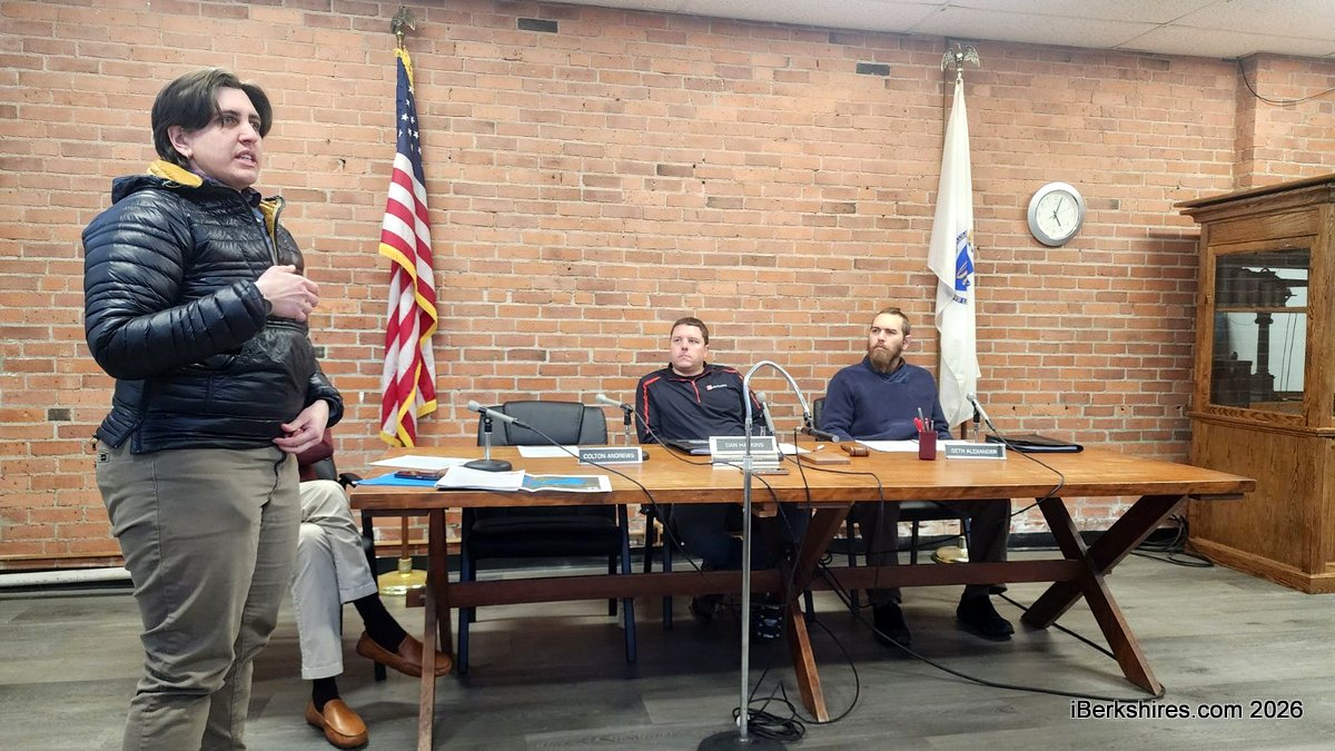
Courteny Morehouse updates the Select Board on several grants at last week's board meeting.
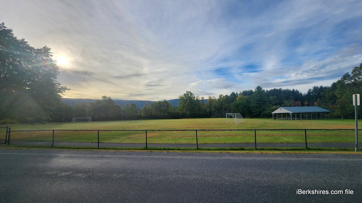
The Four Corners Project is an initiative to improve the field and prepare for better flood solutions in the face of climate change. The area includes Clarksburg School, the Senior/Community Center and the area around the intersections of West Cross, Cross, and Middle roads. It is being funded through a $215,148 Municipal Vulnerability Preparedness.
Courteny Morehouse, principal planner with Berkshire Regional Planning Commission, told the Select Board last week that a postcard had been mailed to residents asking them to attend a workshop on Saturday, Feb. 28, from 10 to 1 in the Clarksburg School cafeteria. There will be plenty of activities, and lunch will be provided.
"We are looking in particular for families and parents with kids to give us input on how they would like the playground to look, where they would like it to go," she said. "What types of equipment would they like to see? What types of equipment wouldn't they like to see? Any concerns with the design as it is, in terms of like, how close it is to parking all of that stuff?"
The project has already been partnering with Flying Cloud Institute, which does science and art programs at the school. It has gathered input from 150 students across the grades on how they like to play.
The town field is just one part of the initiative, which is examining how extreme rainfall will affect this area. A hydrologic and hydraulic study has been completed to determine where flooding will happen in storm events.
Morehouse said the use of terms like 25 and 100-year storms is something of a misnomer.
"It doesn't mean that the storm is necessarily only going to happen every 100 years. It's really saying there's a one percent chance of it happening in any given year," she said. "So this project looks over what areas are vulnerable to flooding, and where that flooding might be, and then how we might mitigate it."
The most concerning area is where Tamarack Brook flows into Hudson Brook, because of the speed at which Hudson flows. The study found that even in smaller storms of 2 to 3 inches, Tamarack ends up backing up.
The houses in that area were built in a wetland, and the wetland is why the brook's velocity is lower: there's not enough gradation. One idea is to look at the pinch points along the brooks, such as undersized culverts and bridges the disrupt the flow; also, extending a berm or taking one out to mitigate flooding and direct it.
The study currently models 100-year storms, but not future storms that may be larger and more frequent. Morehouse said the engineers will be refining the modeling to get more specific data.
"The good news is that the area that we were most concerned about, which was sort of the town field, it looks like, even in the most extreme storm, 100-year storm, it doesn't really completely inundate the field," she said. "You can pretty much use most of the town field, even in recovery of a bigger storm."
The MVP Committee has been leading the way on this study, holding a number of public meetings for input how the field should be used for recreation, parking, access and flood mitigation.
The preliminary design is only the first step to entering a permitting and specification phase and then construction, all of which are expected to be grant funded.
"We're still in the design phase. We're still sort of like figuring out all the pieces," said Morehouse. "But at the end of this two-year grant, we will have engineered designs that we can then start to go, OK, what do we want to construct?"
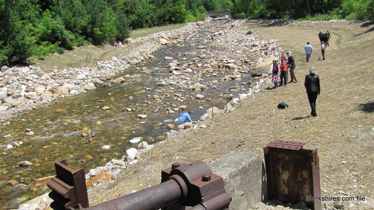
She also updated the board on two other projects that BRPC is facilitating: the Briggsville Bank Erosion Project and the Building Resilient Infrastructure and Communities grant for the water district.
The erosion project refers to the North Branch's eating away at the west bank along Carson Avenue. Since the dam was removed and Tropical Storm Irene, 15 years ago, "that area has lost about 40 feet of land, kind of eroding towards the condominiums there," Morehouse said.
The water isn't getting high enough to flood but the velocity of the flow is causing the erosion. BRPC had funding last year to do a hydrologic and hydraulic study and then modeled some alternatives that didn't seem to work. It acquired more funding this year to look at removing the remaining abutment or removing all or part of the "island" in the middle of the river created by Irene to see if that would reduce the erosion.
She anticipated having more information on that study in June.
"We're hoping to write, with your approval, a grant on behalf of Clarksburg to basically do the design and engineering of this project so that we can not waste ... an entire year before we get more grant funding in there," said Morehouse. The Select Board agreed to submit a letter of support.
The second was the BRIC grant from the Federal Emergency Management Agency to redesign the Briggsville Water District. The town applied for that grant on behalf of the independent water district and will be the conduit for the procurement but it will be administered by BRPC. Town and Briggsville officials recently hashed out an agreement on how that will work.
Morehouse said she'd put together a Request for Response for the whole system with the expectation of releasing it in February and then working with the town administrator when the bids come in.
Tags: mvp, playgrounds, state grant, town field,