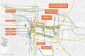
Northern Berkshires Could See Over a Foot of Snow
The U.S. The National Weather Service has declared a snow emergency in effect from 4 pm Thursday, Dec. 15, to Saturday, Dec. 17, at 10 am, in Northern Berkshire County and in Bennington and Western Windham Counties in Vermont.
The U.S. The National Weather Service predicts heavy snow with an accumulation of up to 12 to 18 inches in the Northern Berkshires and the higher elevations of the Green Mountains.
Travel could be difficult to impossible.
Accuweather only predicts between 4-8 inches of snow falling in the Northern Berkshires, with the bulk of the snowfall happening overnight Thursday and throughout Friday.
Greylock Snow Day concurs that there is the potential of 7 plus inches of snow in Northern Berkshire County
Greylock Snow Day does add that warm air could spoil the party for those hoping for a snow day. Warm air could downgrade the snowstorm into a rain event. This could mean a delay instead of a snow day depending on when everything starts to happen.
According to Accuweather, only 3 to 6 inches is expected in Pittsfield. Less is expected in south county.
In a post Wednesday, Greylock Snow Day predicted that at the very least South County schools will have delays. At this point in North County, they expect a full-on snow day for Northern Berkshire schools.
The town of Clarksburg has already declared a snow emergency from Dec. 15, at 9 pm until Dec. 17, at noon.
On Street parking is prohibited
Tags: snow & ice, snow emergencies,