New Pedestrian Bridge at Margaret Lindley Park
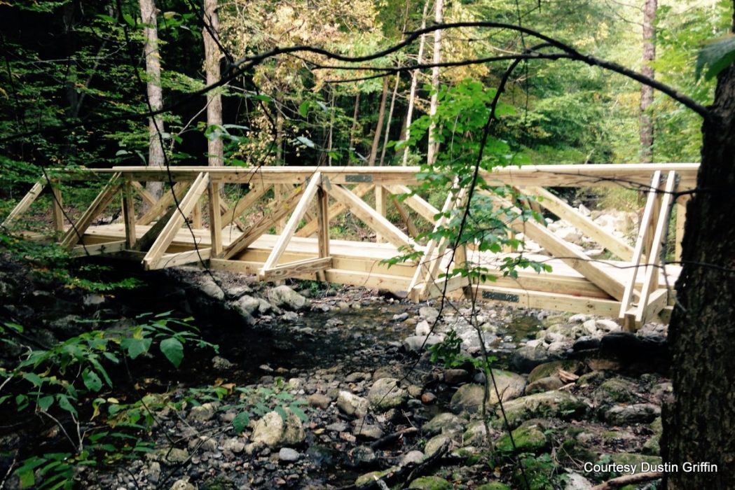 A new bridge has been built over Hemlock Brook. The old one washed away during heavy rainstorms in 2013. A new bridge has been built over Hemlock Brook. The old one washed away during heavy rainstorms in 2013. |
WILLIAMSTOWN, Mass. — The new pedestrian bridge over Hemlock Brook in Margaret Lindley Park fills a void left by torrential rains of May 2013 that swept away the original much-used span.
"Walk the 25 yards upstream from the pond and see it for yourself," suggested Philip McKnight at last week's Conservation Commission meeting. "As John Keats so aptly put it, 'A thing of beauty is a joy forever.' "
With the new handicapped-accessible bridge in place, visitors to the park will be able to cross Hemlock Brook and gain access to the walking trails on the north side of the brook.
The project was initiated by the Conservation Commission, which manages the town-owned park, in consultation with the Trails Group at Williamstown Rural Lands Foundation, said Dustin Griffin of theTrails Group.
It is the first part of a larger plan to create a trail from Margaret Lindley Park to Hopkins Forest, which will include the Hunter property managed by the Conservation Commission.
"Segments of a trail are already in place, others need to be established," Griffin said. "It is our business to think about trails."
McKnight pointed out that such projects are in response to needs expressed to the Rural Lands Foundation for hiking trails where parents can take their children for a healthy, enjoyable activity that holds no danger. And he explained that the Conservation Commission becomes involved with projects that include land it manages.
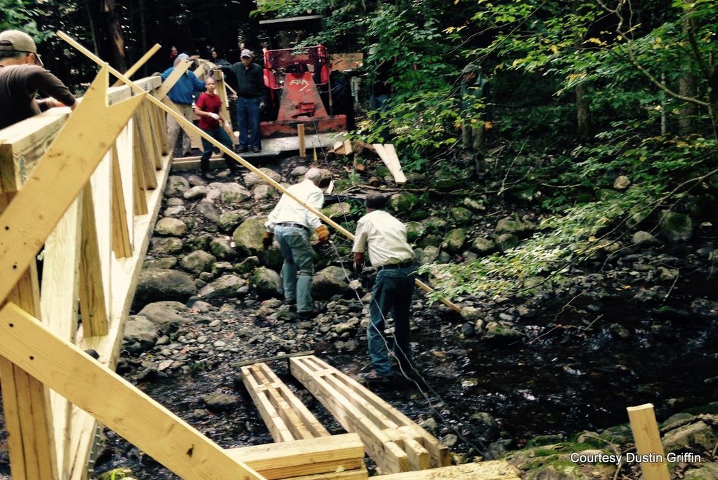
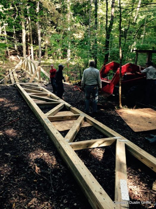 Volunteers helped put the new wood bridge together. Volunteers helped put the new wood bridge together. |
To cover the cost of the new bridge, the Williamstown Rural Lands Foundation contributed $5,000 and secured grants totaling $8,000 from Williamstown Rotary and Fields Pond Foundation.
Volunteers were recruited to help with various aspects of the project that produced the new bridge built entirely of wood, with a span of 38 feet, ensuring that it reaches solid banks on either side of brook.
"Many thanks are in order but to do so individually, with one exception, is to inadvertently miss someone and that would be unfair. The exception is the role our professional carpenter and construction supervisor Jake Lariviere, played, and I believe the core group of six of us who moved this project along each day with the help of so many others would agree," McKnight.
"This project was complicated from a construction point of view, because the plans were not easy to interpret and carry out, and their complexity made the work inherently dangerous. And Jake managed all this with good cheer and with a careful regard for obtaining a consensus on all knotty problems."
McKnight described a task that had to be carried out with great care.
"We made about 300 separate saw cuts, several times three cuts of different lengths and angles on the two ends of a single board to create the notch system the plans called for. Fastening and joining the planks were done on dryland at Sheep Hill (WRLF headquarters) on the forest floor at the bridge site and with both feet in the stream bed. Fortunately, there were no injuries."
The Conservation Commission and the Williamstown Rural Lands Foundation will collaborate again in what will be an ambitous endeavor. They are determined, McKnight said, to establish a "the grand loop" would start from the top of Mount Greylock, go west across Route 43, then Route 7 to Margaret Lindley Park, then north across Route 2 through the Hunter property to Hopkins Forest, east up Pine Cobble to the Appalachain Trail, then south across Route 23 and back up Mount Greylock to the starting point.
In final words about the new pedestrian bridge, perhaps McKnight encourages us to emulate our forefathers:
"It seems to me that in this disparate and in many ways disappointing world we seem to be living in right now ... that the best way to get something done is to gather friends and neighbors around the task to accomplish it ...
"Come to think of it that is the way we built this country."
Tags: bridge, trails,