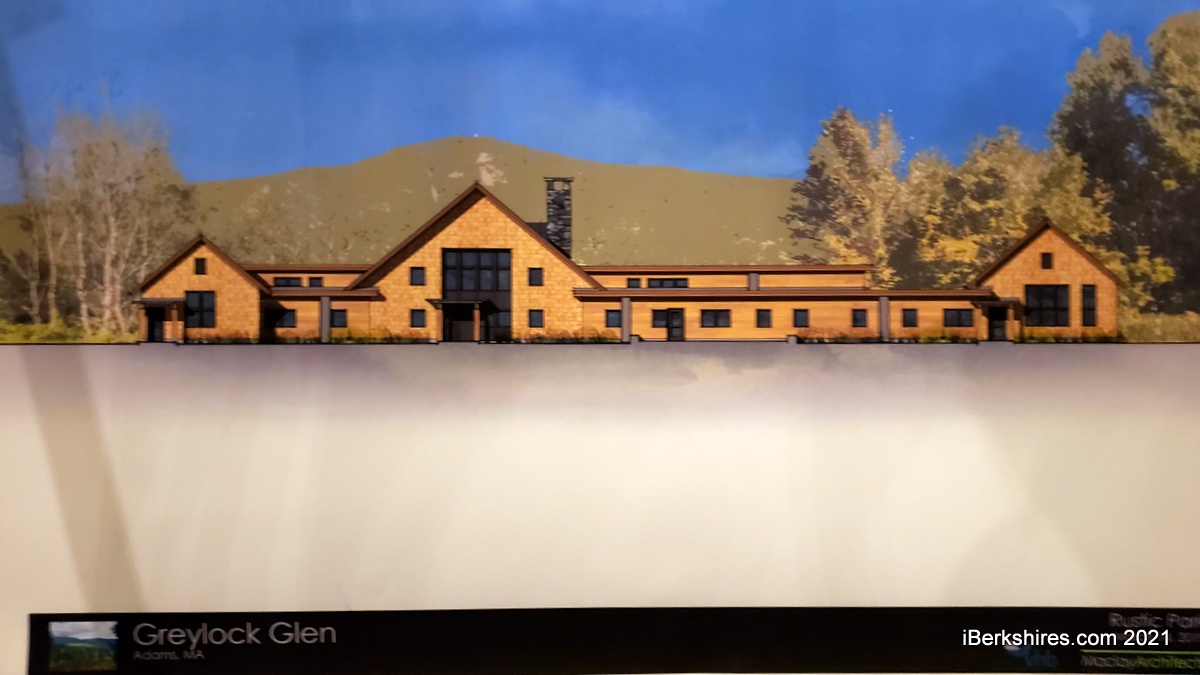
The outdoor center will include exhibition space, classrooms, a restaurant and welcome lobby.
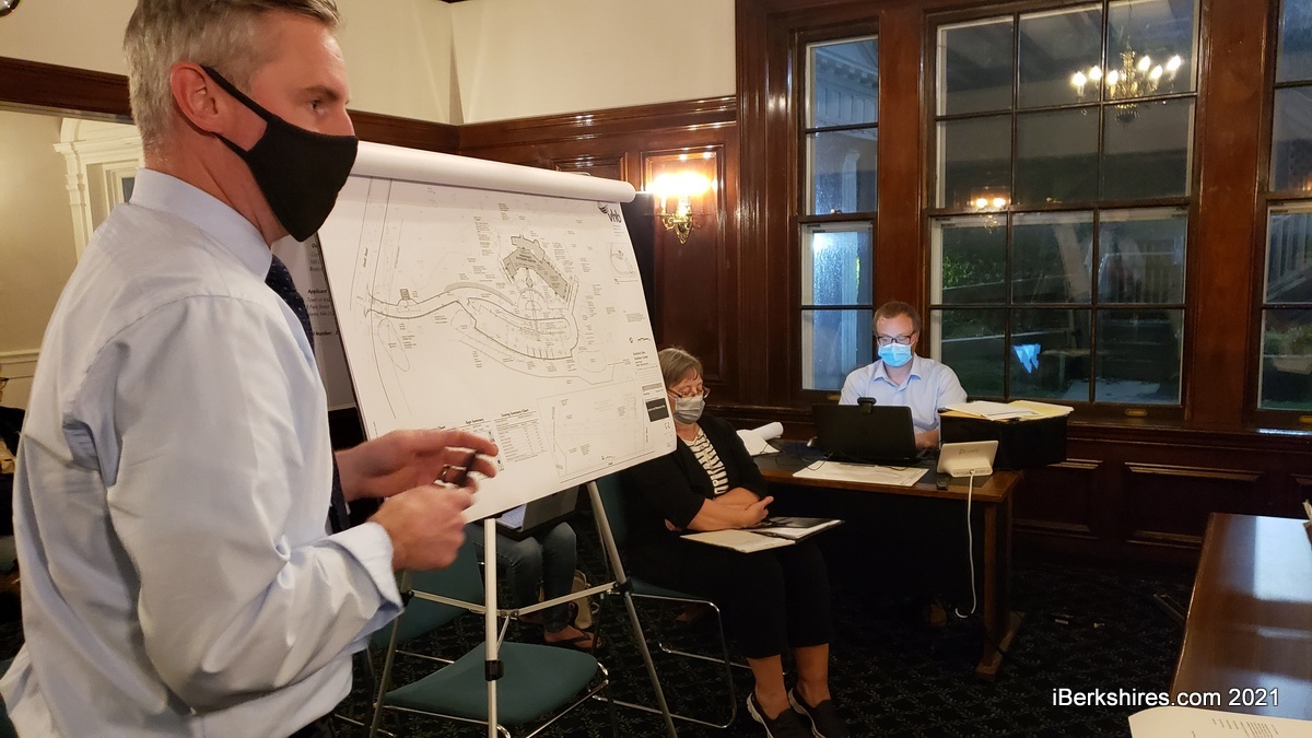
ADAMS, Mass. — The site plans for the new outdoor center at the Greylock Glen was given the stamp of approval on Monday — nearly a decade after the project was first endorsed by the Planning Board.
"I don't know if the board members recall but in July of 2012, this board reviewed the proposed Greylock Glen project and you issued us a special permit under the planned unit resort development," said Donna Cesan, the town's special projects coordinator. "At the time in issuing and approving that special permit, you stated that if after 10 years no development has been initiated, the special permit shall expire.
"So I'm particularly pleased that where we are within that time, bringing the Outdoor Center Project site plan approval to you tonight."
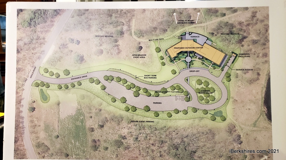
The 9,200-square foot outdoor center, envisioned as a multi-use structure with a 75-seat restaurant, exhibit space and classrooms, was designed by Maclay Architects.
Michael Petrin, project manager with Vanasse Hangen Brustlin Inc., led the board through the stormwater, parking and utility plans for the building.
The center will be located off Gould Road and will include an outdoor patio, paved entrances and 64 parking spaces.
"We have provided a loop around as well the drop-off for buses but also fire apparatus," Petrin said. "We have a stabilized gravel pull-off area, as well as concrete pavers for the walkways.
For stormwater management, there will be swales detention basins around the site, he said. "Our discharge locations are going to be within resource area or buffer zone, that will be jurisdictional under the Conservation Commission. So they will need to approve it."
There were some concerns raised about maintenance of the natural basins but Cesan said these would be maintained by the town just as it maintains parks and other town facilities.
Water and water for fire suppression will come in from Gould Road and sewer will follow the same route. One change in the plans presented to the board was the elimination of a standalone pumphouse for the fire protection line. That was not considered feasible, so it is now attached to the building with a separate water line going in.
Electric lines will be brought in underground as well. Petrin said EV charging stations would eventually be installed.
The board members asked about solar plans and Cesan responded that solar is not part of this phase but is being considered for the future.
"We're investigating that currently, but because of the roofline of the building is so varied it was determined it was impractical to put solar panels on the roof," she said. "We are looking at solar carports ... we'd like to do at least one or two of those as a demonstration, but we're also talking about off-site, provision of solar that would serviced this facility."
The sign-off marks a significant move in finally developing the Greylock Glen. The town was made the developer after a number of other projects fell through over the decades but has struggled to realize a vision first laid out in 2009.
Not that there hasn't been progress: 19 miles of trails have been completed, water and septic lines were extended to Gould Road and the roundabout at Friend and Columbia streets was designed to aid the anticipated increase in traffic.
Future work envisions an amphitheater, campgrounds, and a lodge on the 60-acre parcel of the Mount Greylock State Reservation.
If you would like to contribute information on this article, contact us at info@iberkshires.com.
Your Comments
iBerkshires.com welcomes critical, respectful dialogue. Name-calling, personal attacks, libel, slander or foul language is not allowed. All comments are reviewed before posting and will be deleted or edited as necessary.
No Comments
Air Quality Alert Issued for Berkshire County
Staff reports
WILLIAMSTOWN, Mass. — The state's on an air quality alert through midnight Thursday because of the smoke from wildfires in Canada.
Berkshire residents woke up to smoky, hazy skies and a red glowing sun on Wednesday morning, but with less oppressive heat.
The Department of Environmental Protection issued an air quality alert for elevated levels of fine particles (PM2.5). This refers to microscopic airborne particles measuring 2.5 micrometers or less in diameter — about 30 times smaller than a human hair. These particles come in many sizes and shapes and can be made up of hundreds of different chemicals.
The U.S. Environmental Protection Agency says the size of these particles can cause serious health problems because they can get deep into your lungs and even into bloodstreams. Particles less than 2.5 micrometers in diameter pose the greatest risk to health.
The air quality statewide is expected to be unhealthy for sensitive groups. These include people with heart or lung disease such as asthma, older adults, children, teenagers, and people who are active outdoors. People with either lung disease or heart disease are at greater risk from exposure to air pollution.
MassDEP advises people in sensitive groups to reduce prolonged or heavy outdoor exertion, take more breaks, do less intense activities, follow asthma action plans, and keep quick relief medicine handy. Watch for symptoms such as coughing or shortness of breath.
EPA's air quality index rates levels from "good" at 0-50 and "very unhealthy" from 201 to 300. Residents of Williamstown can track the AQI through PurpleAir, which displays results from monitors in five sections of town.
Cassidy Flynn scattered five hits in a complete-game effort in the circle as Lenox upset top-seeded Hoosac Valley, 3-2, in the quarter-finals of the Division 5 State Tournament. click for more
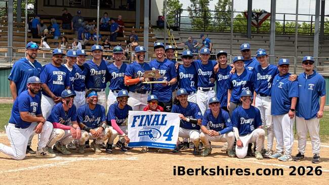
Brayden Durant struck out seven and walked one in a complete-game effort on the mound Saturday to pitch the Drury baseball team to a 6-0 win over Keefe Tech in the quarter-finals of the Division 5 State Tournament at Joe Wolfe Field. click for more
Jason Codey struck out 13, walked two and allowed just an infield single as the Generals earned a 7-1 win over Wahconah to claim their third straight regional title. click for more