Williamstown Planners Dig into Idea of College Zoning Overlay
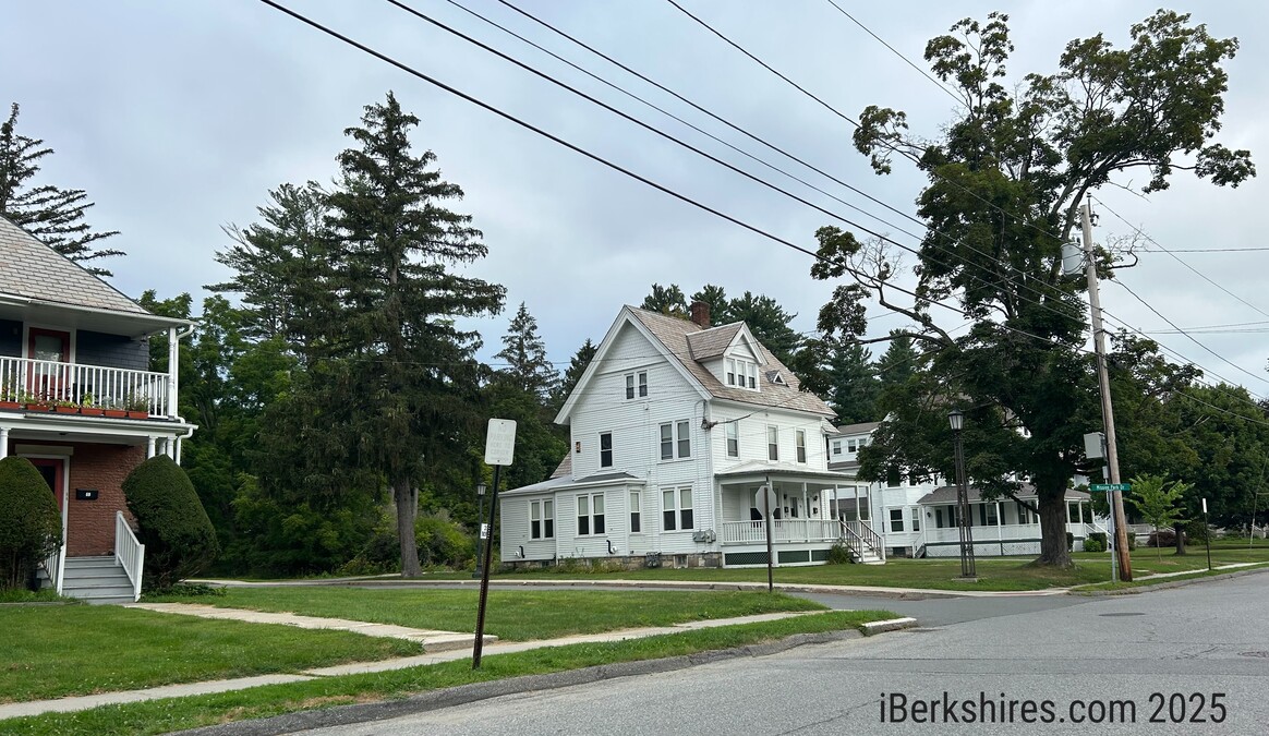
The west side of Southworth Street was singled out during the Planning Board's discussion about distinguishing residential areas from the campus core.
Samantha Page and Community Development Director Andrew Groff recently met with school officials, including Williams' associate vice president for campus planning and operations, to talk about what such an overlay district could look like and how it might streamline the evolution of the college campus.
"I think we're all agreed there could be significant improvements to the process as far as how the college brings large projects for review either with the Planning Board or the Zoning Board," Page told her colleagues. "On our side, I think we see room for improvement so we have a better sense of what may go where.
"It seems like we're all on the same page."
Groff explained the reason for the conversation, including an extreme hypothetical that an overlay district could help the town avoid in the future.
The issue is that Massachusetts does not allow municipalities to constrain non-profit colleges and universities through traditional zoning. Towns can regulate "height, size and bulk of structures, but you can't do so in a way that would practically prohibit them from conducting their educational use," Groff explained.
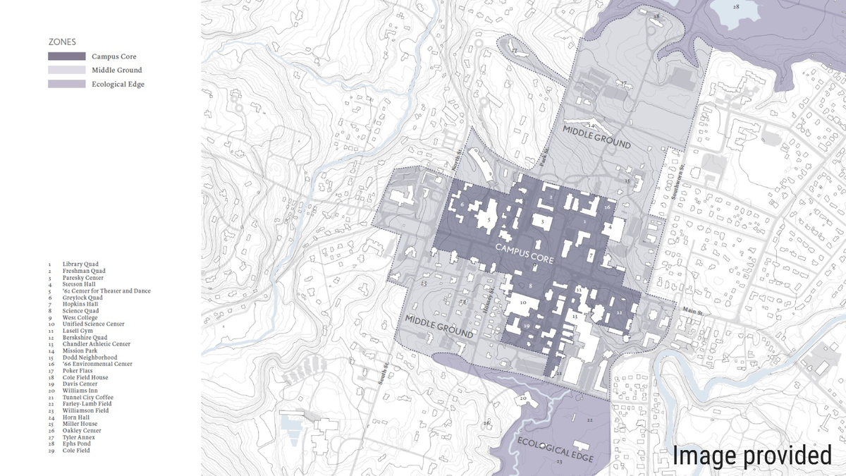
That is why Williams was able, recently, to build its science center buildings, which never would have been permitted in GR for any other property owner.
The Planning Board hopes that, through an overlay district, the town will be able to define parts of Williams' campus that can be more intensively developed and parts where development is more constrained.
"What we're saying, as a municipality, is, 'OK, we're not going to practically prohibit Williams' [land] use,'" Groff said. "We're going to allow them the bulk, size and height of structures they need in what we'll define as the core of their campus. We hope to work with them and agree on what we all believe that [core] is. We can share that judgment and say, 'You can do this here.' "
But, if the overlay also covers parts of campus that are not in the "core," the town could have some protection against undesirable development, in a hypothetical that Groff laid out.
"In the future, when we're all long gone, if someone at the college decides, 'We're going to build something wild like a 15-story building on Cole Field,' the town will have a tools to say, 'We're not practically prohibiting your educational use [by saying no], because you could do something appropriate in the campus core. This area should not be for that,'" Groff said. "We can't do that today.
"An overlay district is an instrument for defining that. I think the goal is to work with Williams to give them predictability so they can plan."
Roger Lawrence asked if the idea was to create a two-tier approach to the land currently occupied by the college: "a denser core and a second level that's more residential."
Groff replied that the overlay district could also include a third "tier," to cover the college's main athletic fields: Cole Field at the north end of campus and Weston Field to the south.
"Something Andrew talked about was trying to use housing as a way to define borders of the campus," Page said. "Like Southworth Street does have residential housing. The college does own property there. Can that area be strengthened as a residential neighborhood, as a way of clearly defining that edge of the campus? … I think they're amenable to something like that."
Lawrence asked if thought was given to increasing the amount of housing on Southworth while preserving the neighborhood's character.
Groff, while emphasizing that talk of a zoning overlay is in its initial stages, said creating that zoning tool could help preserve the neighborhood in question.
"It's a wonderful residential street," he said. "And you, as the casual observer, have no idea that [almost] everything to the west as you're looking north is owned by Williams. That's probably never going to change, but there's no reason not to, sort of, hold their feet to the fire and say, 'This is where the campus stops, and you're going to reinforce that boundary.' We can partially do that through zoning.
"We can't say, 'No, you can't use that as, say, faculty offices or something.' But you can incentivize our bulk, height and size of structure rules to make it so it's logical and practical to do [residential] there and legalize denser, town-house style housing. It meets a need for them, and it forces other, larger structures away."
Lawrence suggested that with townhouses and infill development, the college could "functionally double" the amount of housing on the west side of Southworth Street.
Cory Campbell said the college should be encouraged to develop more in areas that don't "abut up against non-Williams property."
"The point on Southworth Street was you could use it as a residential campus boundary if you're essentially restricting it to a different kind of multifamily, not undergraduate students," Groff said. "The people who live there today are mostly faculty apartments and staff. But you can easily allow them some increased density down there without 'lopsiding' the street and filling it in completely.
"You use that regulation to incentivize neighborhood-scale apartments for the college faculty and staff. And you disincentivize the use of their 'trump card,' so to speak, the fact that they're exempt from use zoning. You make it easier to do [other projects] up by Mission Park. The answer is, 'Why would we do it over there when it's so easy to do it over here?'"
The overlay district, with Page as the point person, is just one project on the Planning Board's radar this year.
In other business last Tuesday, the board heard a report from Lawrence and Ken Kuttner on the open space residential development proposal that they have been working on.
Groff shared a model subdivision regulation developed by the Pioneer Valley Planning Commission that he said the board could use in developing an updated Major Residential Development bylaw.
Tags: overlay districts, Planning Board, Williams College,