Williamstown ZBA Passes Art Museum Project
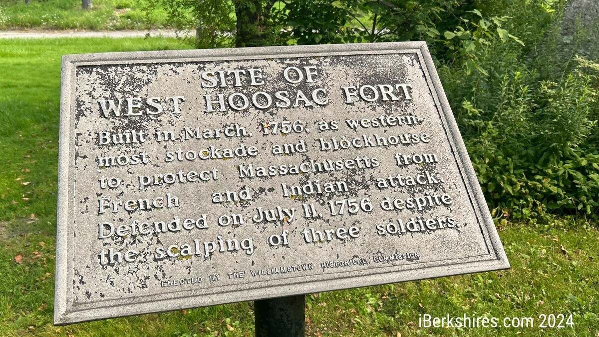
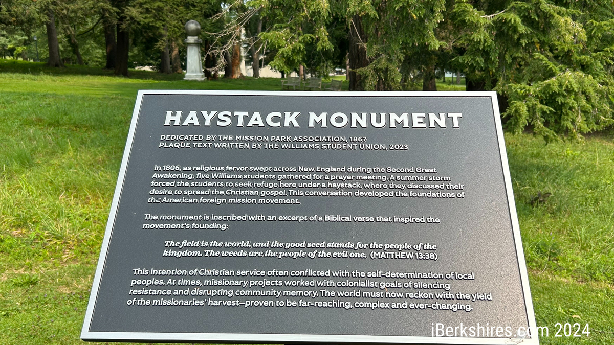
A historical marker commemorates a French and Indian War fort on the site where Williams College plans its new art museum. The college has plans to update the marker, similar to the new marker explaining the Haystack Monument installed last year on campus.
On a vote of 5-0, the board granted the college the two special permits it needed and finalized the body's development plan review, wrapping up a hearing that began in July.
The decision cleared the way for the college to break ground on the project in September with a planned opening in 2027.
First, the college's development team addressed some questions raised by the board during the opening of the hearing and responded to concerns raised by abutters in the Main Street and Fort Hoosac Place neighborhood to the west of the museum site.
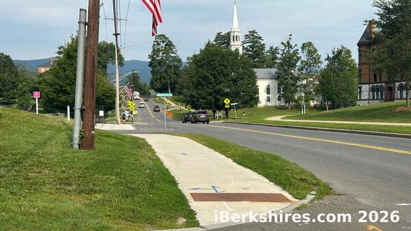
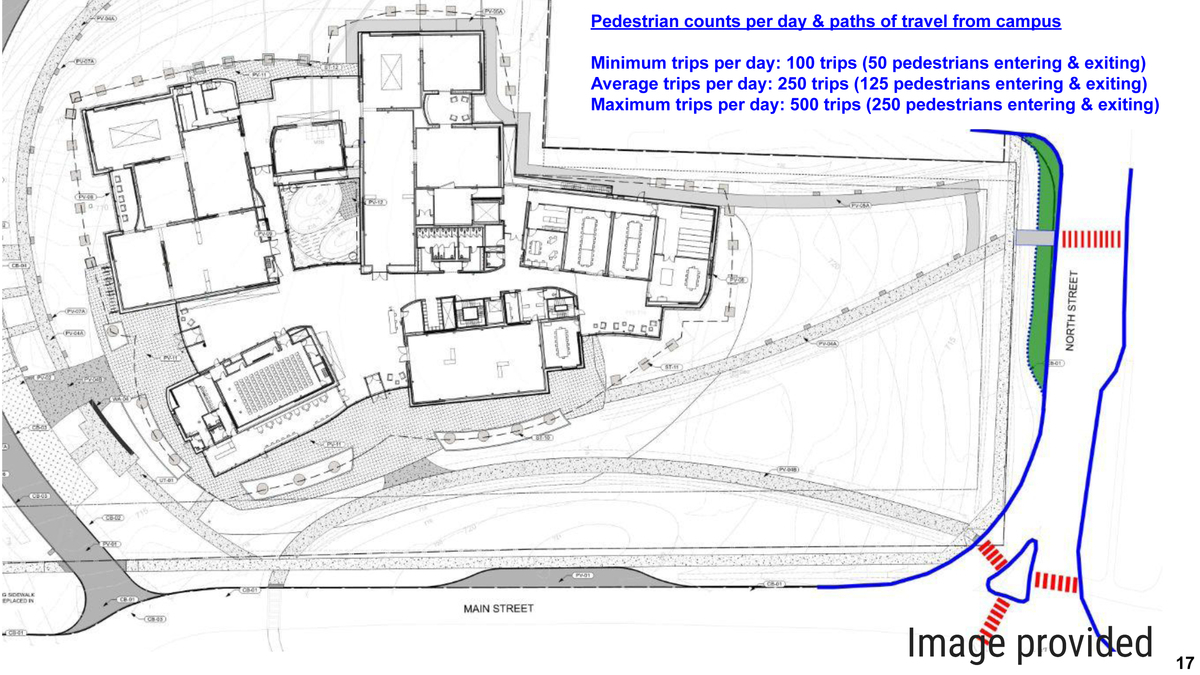
As it did in July, the ZBA pressed college representatives for details on how pedestrian safety would be maintained in what amounts to an extension of the campus across the junction of Routes 2 and 7 (Main Street and North Street) at the Field Park rotary.
"Our anticipation is the current crosswalk at the intersection of 2 and 7 will be the primary crosswalk, and there will be improvements to make that more robust," architect Jonathan Molloy of the New York firm SO-IL told the board.
"This includes some of the classic features of a blinking light with buttons. … Ultimately, we might decide to do something different and more effective."
Later in the discussion, Molloy talked about the possibility that raised crosswalks at the crossing could be part of the solution, emphasizing that the college would be coordinating with the town on how to make the intersection safe.
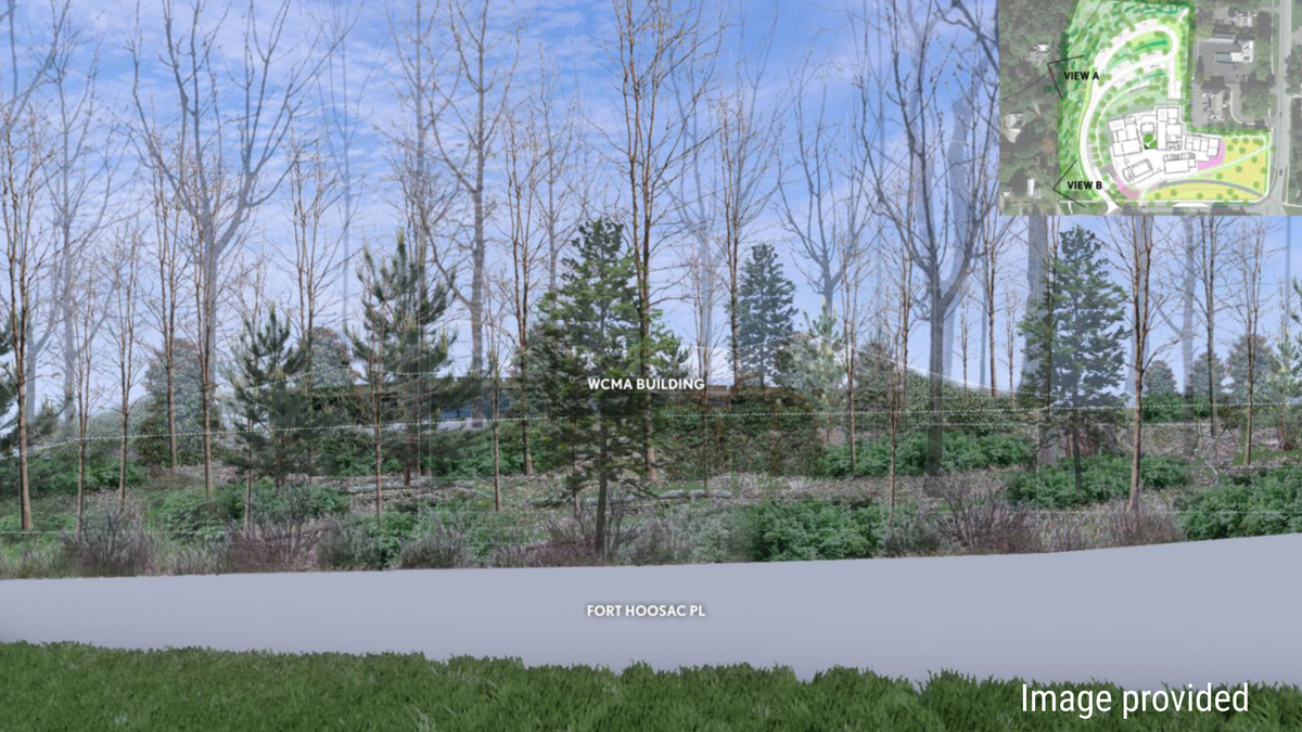
The board also had asked for more details around the landscaping plan for the museum, particularly as it relates to providing the 90 percent opacity screening from parking specified by the town's bylaw.
"You can see it's diverse in its application along the [west edge of the property]," Molloy said of the preliminary planting plan. "Ultimately, it's consistent with the intent of reforesting this edge, bringing back a healthy ecology that is grown and designed not just for current climate conditions but changing climate conditions."
Williams' in-house landscape ecology coordinator told the board that plan is to plant trees of varying height, ranging from 10 feet to 30 feet.
"The understory will be a variety of native shrubs planted in large drifts," Felicity Purzycki said. "Plants tend to be healthier and do better when planted with other species like themselves. A lot of evergreens will be planted, a lot of species with berries. There will be significant fall color. There will be springtime flowers.
"It will bring a lot of ecological integrity we don't currently have along that area."
Density of the planting was a concern for the neighbors, who worried that the new museum would be too visible from their homes.
A focus on Thursday night was the handful of accessible parking spaces near the museum's entrance on the west side of the building.
Fort Hoosac Place resident Jeffrey Strait asked the board to amend its draft motion approving the museum to include language specifying that "dense shrubs" be added on top of a retaining wall framing the west side of the property along the driveway.
ZBA Chair Keith Davis responded by bringing out a point that was made a couple of times at both sessions addressing the application.
"You are not looking for any relief from the screening requirements in the bylaw, are you?" Davis asked college counsel Jamie Art.
"No," Art replied.
"It's covered in the bylaw," Davis told Strait.
Davis also noted that the college could satisfy the town's 90 percent opacity rule with fencing or a concrete wall instead of using foliage and topography, as the board determined the current plan succeeds at doing.
The town's zoning administrator, Community Development Director Andrew Groff, will be responsible for making sure the resulting project has the 90 percent screening specified by the bylaw. Art, later in Thursday's hearing, said the college would continue to take input from neighbors as it achieves that goal.
"With the precise location and specimens still being in the works, I will say what the college has said to other neighbors along the way in terms of plantings on boundaries," Art said. "The college will work with you on placement to the extent that it can, to soften impacts, to broaden screening. If that means adding a few evergreens, I think we can work that out in the scope of the project."
A new issue raised in Thursday's hearing concerned a pair of historical markers on college property commemorating the "West Hoosac Fort" for which the nearby road is named.
Andrew Hoar, a former chair of the ZBA who no longer serves on the board, sent a letter asking why the development plan did not include mention of the markers.
After Art mentioned that the college planned to turn over the current markers to its archivists and create a new commemoration that recontextualizes the French and Indian War battle, Main Street resident Patrick Bandy weighed in.
"I would express a desire to have history preserved rather than reinterpreted," Bandy said. "'Reinterpreted' is a word I hear that sounds similar to 'rewrite.' One thing I learned from those plaques is the rich history of Williamstown and the genesis of the European settlers who came here. I also have learned about the Native American people who owned the land first.
"I think proper context is important. At the same time, living in a house from 1840, I feel an obligation to update my kitchen and preserve the foundation."
Both Art and Groff likened the recontextualization process to the work the college has done to add updated signage near the Haystack Monument, which commemorates the role of Williams students in founding an American missionary movement in 1806.
"I think the college's approach to this has been, in the past, to make sure an appropriate and full explanation of the historical context of the site is preserved and presented in a thoughtful way," Art said. "There is no desire to erase history or sequester something in a way as to hide it. At the same time, there will be a lot of thought given to how the history is presented.
Tags: historic sites, WCMA,