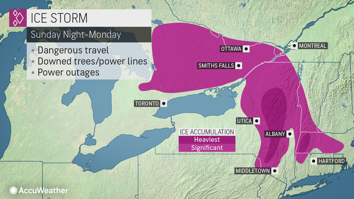
A messy mix of rain, sleet and snow is about to fall over the Berkshires, covering the last days of 2019 in an icy sheet that may make travel "impossible," according to the National Weather Service.
The NWS office in Albany, N.Y., has posted an ice storm warning for the Berkshires and northern Connecticut from 5 p.m. Sunday into 7 a.m. Tuesday.
Significant icing is expected from freezing rain, especially after midnight Sunday night. This icing may cause power outages from tree damage and travel "could be impossible. The hazardous conditions will impact the Monday morning and evening commutes," according to the NWS.
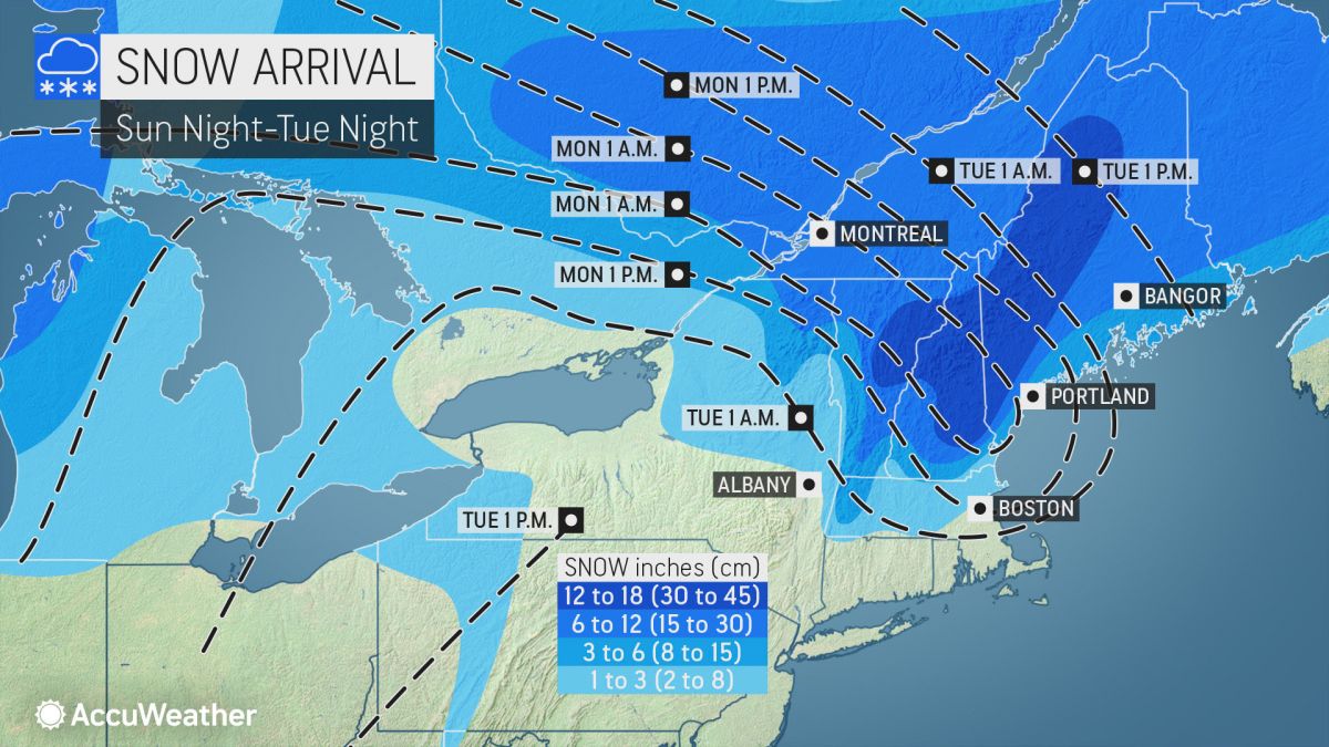
The freezing rain could mix with some sleet late Monday into Monday evening.
A winter storm warning is also in effect from 5 p.m. Sunday and into Tuesday at 1 p.m. for eastern New York and Southern Vermont. Heavy mixed precipitation expected. The storm could bring total snow and sleet accumulations of 1 to 4 inches and ice accumulations of a quarter to a half of an inch. Winds may gust as high as 35 mph.
Snow, sleet and ice accumulations will vary from location to location because of the variations in different precipitation types and the times they arrive over the region.
Accuweather says a warm wedge of air below New England means springlike temperatures for the mid-Atlantic coast. But it means a range of precipitation when hits the cold air hovering over Upstate New York and New England.
"Should the warm air race in a few thousand feet above the ground, then little snow, on the order of a few inches or less, will fall," AccuWeather Senior Meteorologist Brett Anderson said. "Should the cold air resist this warm wedge, then parts of central and northern New England could be buried under a foot of snow or more."
The good news is that January is expected to be warmer than normal across the Northeast with temperatures rising in time for the ball drop on New Year's Eve.
What to expect.....
Right now heaviest ice buildup is expected in the Higher spots west and in the Mohawk Valley....and across Higher Elevations of Western New England. Ice may accumulate over 1/2".....this will cause power outages so be prepared. pic.twitter.com/9NGqQe6WFI
Dangerous travel conditions are expected in the Northern Plains today from a winter storm which could also produce damaging ice accumulations in parts of the interior Northeast on Monday: https://t.co/4itrRLcKgvpic.twitter.com/6HBOAVYBs0
Although a westerly breeze will make the RealFeel Temperatures® feel cooler, quiet and settled conditions are expected in New York City as revelers celebrate the coming of a new year: https://t.co/Pvgl5lXxeIpic.twitter.com/14Tl2qH16A
If you would like to contribute information on this article, contact us at info@iberkshires.com.
Your Comments
iBerkshires.com welcomes critical, respectful dialogue. Name-calling, personal attacks, libel, slander or foul language is not allowed. All comments are reviewed before posting and will be deleted or edited as necessary.
No Comments
RFP Ready for North County High School Study
By Tammy Daniels iBerkshires Staff
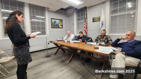
NORTH ADAMS, Mass. — The working group for the Northern Berkshire Educational Collaborative last week approved a request for proposals to study secondary education regional models.
The members on Tuesday fine-tuned the RFP and set a date of Tuesday, Jan. 20, at 4 p.m. to submit bids. The bids must be paper documents and will be accepted at the Northern Berkshire School Union offices on Union Street.
Some members had penned in the first week of January but Timothy Callahan, superintendent for the North Adams schools, thought that wasn't enough time, especially over the holidays.
"I think that's too short of a window if you really want bids," he said. "This is a pretty substantial topic."
That topic is to look at the high school education models in North County and make recommendations to a collaboration between Hoosac Valley Regional and Mount Greylock Regional School Districts, the North Adams Public Schools and the town school districts making up the Northern Berkshire School Union.
The study is being driven by rising costs and dropping enrollment among the three high schools. NBSU's elementary schools go up to Grade 6 or 8 and tuition their students into the local high schools.
The feasibility study of a possible consolidation or collaboration in Grades 7 through 12 is being funded through a $100,000 earmark from the Fair Share Act and is expected to look at academics, faculty, transportation, legal and governance issues, and finances, among other areas.
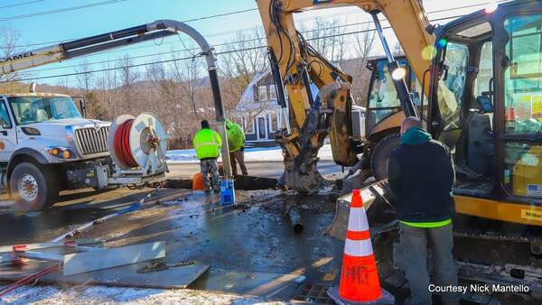
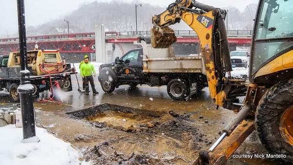
The city has lifted a boil water order — with several exceptions — that was issued late Monday morning following several water line breaks over the weekend. click for more
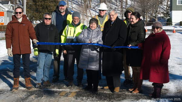
The bridge had been closed to all vehicle traffic since March 2023 after being deemed structurally deficient by the state Department of Transportation. click for more
The Water Department has been responding to multiple water line breaks throughout the city since Friday, causing temporary loss of water in some areas. click for more
Nearly a year of study and community input about the deteriorating Veterans Memorial Bridge has resulted in one recommendation: Take it down. click for more